Matou geodata
Matou (Guangxi) is a seat of a third-order administrative division; located in China in Asia/Shanghai (GMT+8) time zone. In our database, there are 1268 cities with bigger population. Compared to other cities in China, 92.8% of cities are located further ↑North; 82% of cities are located further →East and 54.4% of cities have higher elevation than Matou. Note1


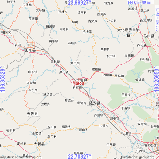
Matou GPS coordinates[2]
23° 21' 19.224" North, 107° 33' 23.04" East
| Map corner | latitude | longitude |
|---|---|---|
| Upper-left | 23.99927°, | 106.85328° |
| Center: | 23.35534°, | 107.5564° |
| Lower-right: | 22.70827°, | 108.25953° |
| Map W x H: | 143.5×143.5 km | = 89.2×89.2mi |
| max Lat: | 53.31946° ⇑92.8% North |
| Matou: | 23.35534° |
| min Lat: | ⇓7.2% South 18.22056° |
| min Long | Matou | max Long |
| 75.07348° | 107.5564° | 134.28917° |
| W 18%⇐ | ⇒82% E |
Elevation
Elevation of Matou is 135 m = 443 ft, and this is 349.8 m = 1148 ft below average elevation for this country.
| Max E: |
5622 m = 18445 ft | 54.4% |
| Avg. | 484.8 m = 1591 ft | |
| Matou | 135 m = 443 ft | |
Min E: |
-3 m = -10 ft | 45.6% |
See also: China elevation on elevation.city.
Geographical zone
Matou is located in North Torrid zone (between Equator and Tropic of Cancer). Distance of this Northern Tropic circle is 9 km =5.6 mi to North.| Distance of | km | miles | from Matou |
|---|---|---|---|
| North Pole | 7410.2 | 4604.5 | to North |
| Arctic Circle | 4804.3 | 2985.3 | to North |
| Tropic Cancer | 9 | 5.6 | to North |
| Equator | 2596.9 | 1613.6 | to South |


Nearby cities:
15 places around Matou: (largest is in red/bold)
• Anyang
85.1 km =52.9 mi,  40°
40°
• Baise City
113.5 km =70.5 mi,  302°
302°
• Baishan
74.2 km =46.1 mi,  57°
57°
• Bama
95.9 km =59.6 mi,  340°
340°
• Chengxiang
76.8 km =47.7 mi,  106°
106°
• Dafeng
106.7 km =66.3 mi,  85°
85°
• Dahua
63.3 km =39.3 mi, 43°
• Debao Chengguanzhen
100.4 km =62.4 mi,  271°
271°
• Long’an Chengxiangzhen
19.1 km =11.9 mi,  149°
149°
• Nanning
98.2 km =61 mi,  127°
127°
• Pingma
56 km =34.8 mi, 304°
• Taocheng
66.9 km =41.6 mi,  217°
217°
• Tiandeng
53.7 km =33.4 mi,  241°
241°
• Tianzhou
82 km =51 mi,  305°
305°
• Xinning
83.4 km =51.8 mi,  155°
155°
Sources, notices
• [Note1] Compared only with cities in China existing in our database
• [Src1] Map data: © OpenStreetMap contributors (CC-BY-SA)
• [Src2] Other city data from geonames.org with taken over terms of usage.
• [Src3] Geographical zone / Annual Mean Temperature by Robert A. Rohde @ Wikipedia
