Laiwu geodata
Laiwu (Shandong) is a populated place; located in China in Asia/Shanghai (GMT+8) time zone. With population of 124,108 people, there are 355 cities with bigger population in this country. Compared to other cities in China, 77.6% of cities are located further ↓South; 69.3% of cities are located further ←West and 52.1% of cities have lower elevation than Laiwu. Note1


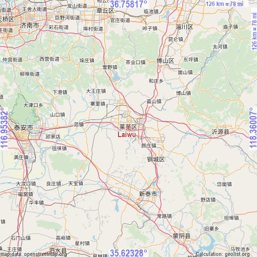
Laiwu GPS coordinates[2]
36° 11' 34.008" North, 117° 39' 24.984" East
| Map corner | latitude | longitude |
|---|---|---|
| Upper-left | 36.75817°, | 116.95382° |
| Center: | 36.19278°, | 117.65694° |
| Lower-right: | 35.62328°, | 118.36007° |
| Map W x H: | 126.2×126.2 km | = 78.4×78.4mi |
| max Lat: | 53.31946° ⇑22.4% North |
| Laiwu: | 36.19278° |
| min Lat: | ⇓77.6% South 18.22056° |
| min Long | Laiwu | max Long |
| 75.07348° | 117.65694° | 134.28917° |
| W 69.3%⇐ | ⇒30.7% E |
Elevation
Elevation of Laiwu is 182 m = 597 ft, and this is 302.8 m = 993 ft below average elevation for this country.
| Max E: |
5622 m = 18445 ft | 47.9% |
| Avg. | 484.8 m = 1591 ft | |
| Laiwu | 182 m = 597 ft | |
Min E: |
-3 m = -10 ft | 52.1% |
See also: Laiwu elevation on elevation.city.
Geographical zone
Laiwu is located in North temperate zone (between Tropic of Cancer and the Arctic Circle). Distance of this Northern Tropic circle is 1418.3 km =881.3 mi to South.| Distance of | km | miles | from Laiwu |
|---|---|---|---|
| North Pole | 5982.8 | 3717.5 | to North |
| Arctic Circle | 3376.9 | 2098.3 | to North |
| Tropic Cancer | 1418.3 | 881.3 | to South |
| Equator | 4024.3 | 2500.6 | to South |


Nearby cities:
15 places around Laiwu: (largest is in red/bold)
• Boshan
36 km =22.4 mi,  26°
26°
• Dongdu
38.3 km =23.8 mi,  174°
174°
• Dongping
45.6 km =28.3 mi,  41°
41°
• Feicheng
80.2 km =49.8 mi,  274°
274°
• Jinan
79.2 km =49.2 mi,  311°
311°
• Mengyin
59.2 km =36.8 mi,  155°
155°
• Mingshui
59.9 km =37.2 mi,  346°
346°
• Nanding
71.3 km =44.3 mi, 30°
• Nanma
44.7 km =27.8 mi,  91°
91°
• Pingyi
77 km =47.8 mi,  181°
181°
• Sishui
69.5 km =43.2 mi,  209°
209°
• Tai’an
48.2 km =30 mi, 269°
• Xintai
33.6 km =20.9 mi, 165°
• Zhoucun
70.8 km =44 mi,  11°
11°
• Zibo
75.7 km =47 mi, 28°
Sources, notices
• [Note1] Compared only with cities in China existing in our database
• [Src1] Map data: © OpenStreetMap contributors (CC-BY-SA)
• [Src2] Other city data from geonames.org with taken over terms of usage.
• [Src3] Geographical zone / Annual Mean Temperature by Robert A. Rohde @ Wikipedia
