Jinchang geodata
Jinchang (Gansu) is a seat of a second-order administrative division; located in China in Asia/Shanghai (GMT+8) time zone. With population of 144,363 people, there are 310 cities with bigger population in this country. Compared to other cities in China, 81.8% of cities are located further ↓South; 92.6% of cities are located further →East and 91.8% of cities have lower elevation than Jinchang. Note1


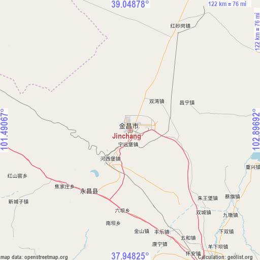
Jinchang GPS coordinates[2]
38° 30' 2.232" North, 102° 11' 37.644" East
| Map corner | latitude | longitude |
|---|---|---|
| Upper-left | 39.04878°, | 101.49067° |
| Center: | 38.50062°, | 102.19379° |
| Lower-right: | 37.94825°, | 102.89692° |
| Map W x H: | 122.4×122.4 km | = 76.1×76.1mi |
| max Lat: | 53.31946° ⇑18.2% North |
| Jinchang: | 38.50062° |
| min Lat: | ⇓81.8% South 18.22056° |
| min Long | Jinchang | max Long |
| 75.07348° | 102.19379° | 134.28917° |
| W 7.4%⇐ | ⇒92.6% E |
Elevation
Elevation of Jinchang is 1553 m = 5095 ft, and this is 1068.2 m = 3505 ft above average elevation for this country.
| Max E: |
5622 m = 18445 ft | 8.2% |
| Jinchang | 1553 m 5095 ft | |
| Avg. | 484.8 m = 1591 ft | |
Min E: |
-3 m = -10 ft | 91.8% |
See also: Jinchang elevation on elevation.city.
Geographical zone
Jinchang is located in North temperate zone (between Tropic of Cancer and the Arctic Circle). Distance of this Northern Tropic circle is 1674.9 km =1040.7 mi to South.| Distance of | km | miles | from Jinchang |
|---|---|---|---|
| North Pole | 5726.2 | 3558.1 | to North |
| Arctic Circle | 3120.3 | 1938.9 | to North |
| Tropic Cancer | 1674.9 | 1040.7 | to South |
| Equator | 4280.9 | 2660 | to South |


Nearby cities:
15 places around Jinchang: (largest is in red/bold)
• Ailibugai
68 km =42.3 mi,  306°
306°
• Beitan
73.7 km =45.8 mi,  206°
206°
• Damaying
87.8 km =54.6 mi,  260°
260°
• Dongdajie
74.5 km =46.3 mi,  148°
148°
• Dongtan
78.7 km =48.9 mi, 205°
• Ehen Hudag
91.1 km =56.6 mi,  330°
330°
• Guangzhoulu
2.2 km =1.4 mi,  265°
265°
• Hongshanyao
56.3 km =35 mi,  246°
246°
• Huazhaizi
85 km =52.8 mi, 269°
• Maying
71.6 km =44.5 mi,  215°
215°
• Sanlei
79 km =49.1 mi,  79°
79°
• Wuwei
74.4 km =46.2 mi, 149°
• Xinchengzi
62.7 km =39 mi,  235°
235°
• Yangxiang
59.5 km =37 mi,  197°
197°
• Yongchang Chengguanzhen
29.7 km =18.5 mi, 210°
Sources, notices
• [Note1] Compared only with cities in China existing in our database
• [Src1] Map data: © OpenStreetMap contributors (CC-BY-SA)
• [Src2] Other city data from geonames.org with taken over terms of usage.
• [Src3] Geographical zone / Annual Mean Temperature by Robert A. Rohde @ Wikipedia
