Wuwei geodata
Wuwei (Gansu) is a seat of a second-order administrative division; located in China in Asia/Shanghai (GMT+8) time zone. With population of 493,092 people, there are 130 cities with bigger population in this country. Compared to other cities in China, 80.8% of cities are located further ↓South; 92.1% of cities are located further →East and 91.7% of cities have lower elevation than Wuwei. Note1


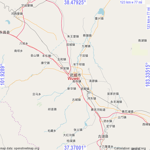
Wuwei GPS coordinates[2]
37° 55' 36.192" North, 102° 37' 55.272" East
| Map corner | latitude | longitude |
|---|---|---|
| Upper-left | 38.47925°, | 101.9289° |
| Center: | 37.92672°, | 102.63202° |
| Lower-right: | 37.37001°, | 103.33515° |
| Map W x H: | 123.3×123.3 km | = 76.6×76.6mi |
| max Lat: | 53.31946° ⇑19.2% North |
| Wuwei: | 37.92672° |
| min Lat: | ⇓80.8% South 18.22056° |
| min Long | Wuwei | max Long |
| 75.07348° | 102.63202° | 134.28917° |
| W 7.9%⇐ | ⇒92.1% E |
Elevation
Elevation of Wuwei is 1542 m = 5059 ft, and this is 1057.2 m = 3469 ft above average elevation for this country.
| Max E: |
5622 m = 18445 ft | 8.3% |
| Wuwei | 1542 m 5059 ft | |
| Avg. | 484.8 m = 1591 ft | |
Min E: |
-3 m = -10 ft | 91.7% |
See also: Wuwei elevation on elevation.city.
Geographical zone
Wuwei is located in North temperate zone (between Tropic of Cancer and the Arctic Circle). Distance of this Northern Tropic circle is 1611.1 km =1001.1 mi to South.| Distance of | km | miles | from Wuwei |
|---|---|---|---|
| North Pole | 5790 | 3597.7 | to North |
| Arctic Circle | 3184.1 | 1978.5 | to North |
| Tropic Cancer | 1611.1 | 1001.1 | to South |
| Equator | 4217.1 | 2620.4 | to South |


Nearby cities:
15 places around Wuwei: (largest is in red/bold)
• Beitan
71.1 km =44.2 mi,  268°
268°
• Dongchuan
93.7 km =58.2 mi,  228°
228°
• Dongdajie
0.2 km =0.1 mi,  85°
85°
• Dongtan
72.8 km =45.2 mi,  264°
264°
• Guangzhoulu
75.5 km =46.9 mi,  327°
327°
• Gulang
56.1 km =34.9 mi,  155°
155°
• Hongshanyao
99.4 km =61.8 mi,  294°
294°
• Huazangsi
114.6 km =71.2 mi, 157°
• Jinchang
74.4 km =46.2 mi, 329°
• Maying
80.7 km =50.1 mi, 274°
• Qingshizui
117.2 km =72.8 mi,  244°
244°
• Sanlei
87.4 km =54.3 mi,  27°
27°
• Xinchengzi
94.8 km =58.9 mi, 287°
• Yangxiang
56.5 km =35.1 mi,  277°
277°
• Yongchang Chengguanzhen
65.8 km =40.9 mi,  305°
305°
Sources, notices
• [Note1] Compared only with cities in China existing in our database
• [Src1] Map data: © OpenStreetMap contributors (CC-BY-SA)
• [Src2] Other city data from geonames.org with taken over terms of usage.
• [Src3] Geographical zone / Annual Mean Temperature by Robert A. Rohde @ Wikipedia
