Jiancheng geodata
Jiancheng (Sichuan) is a seat of a third-order administrative division; located in China in Asia/Shanghai (GMT+8) time zone. In our database, there are 1268 cities with bigger population. Compared to other cities in China, 50.5% of cities are located further ↑North; 89.6% of cities are located further →East and 69.9% of cities have lower elevation than Jiancheng. Note1


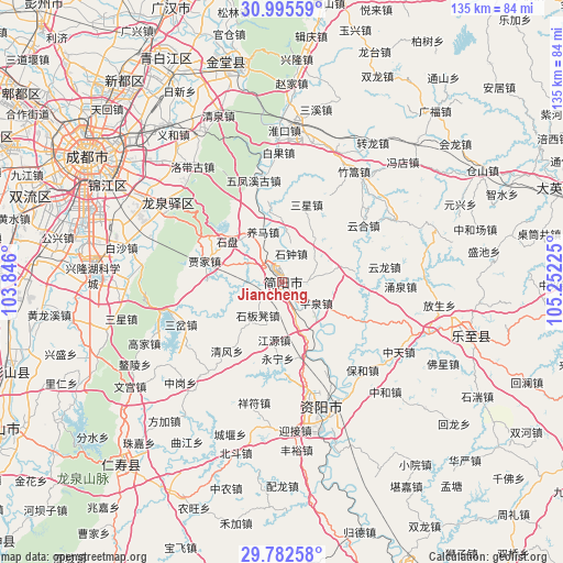
Jiancheng GPS coordinates[2]
30° 23' 27.492" North, 104° 32' 56.832" East
| Map corner | latitude | longitude |
|---|---|---|
| Upper-left | 30.99559°, | 103.846° |
| Center: | 30.39097°, | 104.54912° |
| Lower-right: | 29.78258°, | 105.25225° |
| Map W x H: | 134.9×134.9 km | = 83.8×83.8mi |
| max Lat: | 53.31946° ⇑50.5% North |
| Jiancheng: | 30.39097° |
| min Lat: | ⇓49.5% South 18.22056° |
| min Long | Jiancheng | max Long |
| 75.07348° | 104.54912° | 134.28917° |
| W 10.4%⇐ | ⇒89.6% E |
Elevation
Elevation of Jiancheng is 409 m = 1342 ft, and this is 75.8 m = 249 ft below average elevation for this country.
| Max E: |
5622 m = 18445 ft | 30.1% |
| Avg. | 484.8 m = 1591 ft | |
| Jiancheng | 409 m = 1342 ft | |
Min E: |
-3 m = -10 ft | 69.9% |
See also: China elevation on elevation.city.
Geographical zone
Jiancheng is located in North temperate zone (between Tropic of Cancer and the Arctic Circle). Distance of this Northern Tropic circle is 773.2 km =480.4 mi to South.| Distance of | km | miles | from Jiancheng |
|---|---|---|---|
| North Pole | 6627.9 | 4118.4 | to North |
| Arctic Circle | 4022 | 2499.2 | to North |
| Tropic Cancer | 773.2 | 480.4 | to South |
| Equator | 3379.2 | 2099.7 | to South |


Nearby cities:
15 places around Jiancheng: (largest is in red/bold)
• Chengdu
55.5 km =34.5 mi,  303°
303°
• Chonglong
73.9 km =45.9 mi,  156°
156°
• Dongsheng
63.5 km =39.5 mi,  288°
288°
• Kaijiang
73.1 km =45.4 mi,  9°
9°
• Liucheng
76.3 km =47.4 mi, 296°
• Longquan
32.9 km =20.4 mi,  305°
305°
• Luocheng
70.4 km =43.7 mi,  338°
338°
• Penglai
70.6 km =43.9 mi,  72°
72°
• Tianchi
47.1 km =29.3 mi,  105°
105°
• Wenlin
58.8 km =36.5 mi,  221°
221°
• Wujin
70.6 km =43.9 mi,  271°
271°
• Xindu
60.9 km =37.8 mi,  321°
321°
• Xipu
68.8 km =42.8 mi, 306°
• Yanjiang
31.5 km =19.6 mi, 162°
• Zhaozhen
52.9 km =32.9 mi,  348°
348°
Sources, notices
• [Note1] Compared only with cities in China existing in our database
• [Src1] Map data: © OpenStreetMap contributors (CC-BY-SA)
• [Src2] Other city data from geonames.org with taken over terms of usage.
• [Src3] Geographical zone / Annual Mean Temperature by Robert A. Rohde @ Wikipedia
