Huquan geodata
Huquan (Shanxi) is a seat of a third-order administrative division; located in China in Asia/Shanghai (GMT+8) time zone. In our database, there are 1268 cities with bigger population. Compared to other cities in China, 85.6% of cities are located further ↓South; 50.3% of cities are located further →East and 87.3% of cities have lower elevation than Huquan. Note1


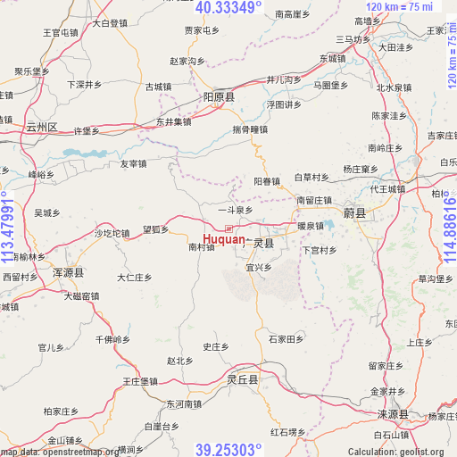
Huquan GPS coordinates[2]
39° 47' 43.368" North, 114° 10' 58.908" East
| Map corner | latitude | longitude |
|---|---|---|
| Upper-left | 40.33349°, | 113.47991° |
| Center: | 39.79538°, | 114.18303° |
| Lower-right: | 39.25303°, | 114.88616° |
| Map W x H: | 120.1×120.1 km | = 74.6×74.6mi |
| max Lat: | 53.31946° ⇑14.4% North |
| Huquan: | 39.79538° |
| min Lat: | ⇓85.6% South 18.22056° |
| min Long | Huquan | max Long |
| 75.07348° | 114.18303° | 134.28917° |
| W 49.7%⇐ | ⇒50.3% E |
Elevation
Elevation of Huquan is 1137 m = 3730 ft, and this is 652.2 m = 2140 ft above average elevation for this country.
| Max E: |
5622 m = 18445 ft | 12.7% |
| Huquan | 1137 m 3730 ft | |
| Avg. | 484.8 m = 1591 ft | |
Min E: |
-3 m = -10 ft | 87.3% |
See also: China elevation on elevation.city.
Geographical zone
Huquan is located in North temperate zone (between Tropic of Cancer and the Arctic Circle). Distance of this Northern Tropic circle is 1818.9 km =1130.2 mi to South.| Distance of | km | miles | from Huquan |
|---|---|---|---|
| North Pole | 5582.2 | 3468.6 | to North |
| Arctic Circle | 2976.3 | 1849.4 | to North |
| Tropic Cancer | 1818.9 | 1130.2 | to South |
| Equator | 4424.8 | 2749.4 | to South |


Nearby cities:
15 places around Huquan: (largest is in red/bold)
• Aoshi
26.6 km =16.5 mi,  315°
315°
• Caicun
46 km =28.6 mi,  262°
262°
• Daciyao
42.6 km =26.5 mi,  245°
245°
• Darenzhuang
27.9 km =17.3 mi,  243°
243°
• Huanghuatan
33.2 km =20.6 mi, 241°
• Qianfoling
42.2 km =26.2 mi,  226°
226°
• Qingciyao
40.5 km =25.2 mi, 241°
• Wanghu
19.2 km =11.9 mi,  270°
270°
• Wangzhuangbu
46.4 km =28.8 mi,  210°
210°
• Wuling
36.5 km =22.7 mi,  184°
184°
• Xicheng
35.1 km =21.8 mi,  356°
356°
• Xubu
45.5 km =28.3 mi,  304°
304°
• Yong’an
43.8 km =27.2 mi, 255°
• Youzai
30.5 km =19 mi, 304°
• Zhaobei
36.9 km =22.9 mi,  200°
200°
Sources, notices
• [Note1] Compared only with cities in China existing in our database
• [Src1] Map data: © OpenStreetMap contributors (CC-BY-SA)
• [Src2] Other city data from geonames.org with taken over terms of usage.
• [Src3] Geographical zone / Annual Mean Temperature by Robert A. Rohde @ Wikipedia
