Xicheng geodata
Xicheng (Hebei) is a seat of a third-order administrative division; located in China in Asia/Shanghai (GMT+8) time zone. In our database, there are 1268 cities with bigger population. Compared to other cities in China, 86.8% of cities are located further ↓South; 50.4% of cities are located further →East and 84.1% of cities have lower elevation than Xicheng. Note1


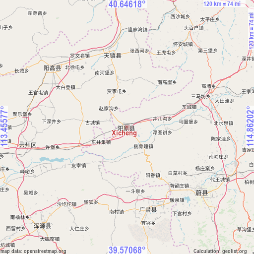
Xicheng GPS coordinates[2]
40° 6' 38.016" North, 114° 9' 32.004" East
| Map corner | latitude | longitude |
|---|---|---|
| Upper-left | 40.64618°, | 113.45577° |
| Center: | 40.11056°, | 114.15889° |
| Lower-right: | 39.57068°, | 114.86202° |
| Map W x H: | 119.6×119.6 km | = 74.3×74.3mi |
| max Lat: | 53.31946° ⇑13.2% North |
| Xicheng: | 40.11056° |
| min Lat: | ⇓86.8% South 18.22056° |
| min Long | Xicheng | max Long |
| 75.07348° | 114.15889° | 134.28917° |
| W 49.6%⇐ | ⇒50.4% E |
Elevation
Elevation of Xicheng is 924 m = 3031 ft, and this is 439.2 m = 1441 ft above average elevation for this country.
| Max E: |
5622 m = 18445 ft | 15.9% |
| Xicheng | 924 m 3031 ft | |
| Avg. | 484.8 m = 1591 ft | |
Min E: |
-3 m = -10 ft | 84.1% |
See also: China elevation on elevation.city.
Geographical zone
Xicheng is located in North temperate zone (between Tropic of Cancer and the Arctic Circle). Distance of this Northern Tropic circle is 1854 km =1152 mi to South.| Distance of | km | miles | from Xicheng |
|---|---|---|---|
| North Pole | 5547.2 | 3446.9 | to North |
| Arctic Circle | 2941.3 | 1827.6 | to North |
| Tropic Cancer | 1854 | 1152 | to South |
| Equator | 4459.9 | 2771.3 | to South |


Nearby cities:
15 places around Xicheng: (largest is in red/bold)
• Aoshi
22.9 km =14.2 mi,  225°
225°
• Darenzhuang
52.7 km =32.7 mi,  205°
205°
• Fengyu
51.4 km =31.9 mi,  246°
246°
• Guayuan
44.2 km =27.5 mi,  256°
256°
• Huanghuatan
57.6 km =35.8 mi, 208°
• Huquan
35.1 km =21.8 mi,  176°
176°
• Jule
50 km =31.1 mi,  276°
276°
• Longquan
50.4 km =31.3 mi,  303°
303°
• Wanghu
39 km =24.2 mi, 206°
• Wucheng
55 km =34.2 mi,  236°
236°
• Xiping
47.8 km =29.7 mi, 260°
• Xubu
36.4 km =22.6 mi, 255°
• Youzai
29.1 km =18.1 mi, 232°
• Yuquan
40.1 km =24.9 mi,  337°
337°
• Zhoushizhuang
58.9 km =36.6 mi,  270°
270°
Sources, notices
• [Note1] Compared only with cities in China existing in our database
• [Src1] Map data: © OpenStreetMap contributors (CC-BY-SA)
• [Src2] Other city data from geonames.org with taken over terms of usage.
• [Src3] Geographical zone / Annual Mean Temperature by Robert A. Rohde @ Wikipedia
