Duyun geodata
Duyun (Guizhou) is a populated place; located in China in Asia/Shanghai (GMT+8) time zone. With population of 91,136 people, there are 464 cities with bigger population in this country. Compared to other cities in China, 81.3% of cities are located further ↑North; 82.1% of cities are located further →East and 82.4% of cities have lower elevation than Duyun. Note1
Administrative division(s):
- Level 1: Guizhou
- Level 2: Qiannan Bouyeizu Miaozu Zizhizhou
- Level 3: Duyun Shi


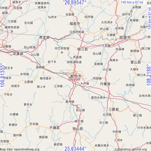
Duyun GPS coordinates[2]
26° 16' 0.012" North, 107° 31' 0.012" East
| Map corner | latitude | longitude |
|---|---|---|
| Upper-left | 26.89547°, | 106.81355° |
| Center: | 26.26667°, | 107.51667° |
| Lower-right: | 25.63444°, | 108.2198° |
| Map W x H: | 140.2×140.2 km | = 87.1×87.1mi |
| max Lat: | 53.31946° ⇑81.3% North |
| Duyun: | 26.26667° |
| min Lat: | ⇓18.7% South 18.22056° |
| min Long | Duyun | max Long |
| 75.07348° | 107.51667° | 134.28917° |
| W 17.9%⇐ | ⇒82.1% E |
Elevation
Elevation of Duyun is 815 m = 2674 ft, and this is 330.2 m = 1083 ft above average elevation for this country.
| Max E: |
5622 m = 18445 ft | 17.6% |
| Duyun | 815 m 2674 ft | |
| Avg. | 484.8 m = 1591 ft | |
Min E: |
-3 m = -10 ft | 82.4% |
See also: Duyun elevation on elevation.city.
Geographical zone
Duyun is located in North temperate zone (between Tropic of Cancer and the Arctic Circle). Distance of this Northern Tropic circle is 314.7 km =195.5 mi to South.| Distance of | km | miles | from Duyun |
|---|---|---|---|
| North Pole | 7086.5 | 4403.3 | to North |
| Arctic Circle | 4480.6 | 2784.1 | to North |
| Tropic Cancer | 314.7 | 195.5 | to South |
| Equator | 2920.6 | 1814.8 | to South |


Nearby cities:
15 places around Duyun: (largest is in red/bold)
• Dingdan
87.9 km =54.6 mi,  121°
121°
• Guiyang
87.1 km =54.1 mi,  293°
293°
• Jiaoxi
137.7 km =85.6 mi,  48°
48°
• Liupai
140.7 km =87.4 mi,  194°
194°
• Maolan
112.4 km =69.8 mi,  150°
150°
• Nandan Chengguanzhen
139.7 km =86.8 mi,  178°
178°
• Pingjiang
93.7 km =58.2 mi,  110°
110°
• Pingjiang
125.1 km =77.7 mi, 113°
• Shangjiang
69.1 km =42.9 mi, 121°
• Supu
141.9 km =88.2 mi,  304°
304°
• Tingdong
120 km =74.6 mi, 114°
• Xiajiang
130.5 km =81.1 mi, 115°
• Xiaoweizhai
8.5 km =5.3 mi, 182°
• Yaolu
105.5 km =65.6 mi, 149°
• Yongxi
115.9 km =72 mi,  44°
44°
Sources, notices
• [Note1] Compared only with cities in China existing in our database
• [Src1] Map data: © OpenStreetMap contributors (CC-BY-SA)
• [Src2] Other city data from geonames.org with taken over terms of usage.
• [Src3] Geographical zone / Annual Mean Temperature by Robert A. Rohde @ Wikipedia
