Xiaoweizhai geodata
Xiaoweizhai (Guizhou) is a populated place; located in China in Asia/Shanghai (GMT+8) time zone. With population of 58,913 people, there are 748 cities with bigger population in this country. Compared to other cities in China, 81.6% of cities are located further ↑North; 82.1% of cities are located further →East and 81.3% of cities have lower elevation than Xiaoweizhai. Note1


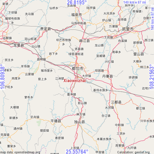
Xiaoweizhai GPS coordinates[2]
26° 11' 25.008" North, 107° 30' 45" East
| Map corner | latitude | longitude |
|---|---|---|
| Upper-left | 26.8195°, | 106.80938° |
| Center: | 26.19028°, | 107.5125° |
| Lower-right: | 25.55764°, | 108.21563° |
| Map W x H: | 140.3×140.3 km | = 87.2×87.2mi |
| max Lat: | 53.31946° ⇑81.6% North |
| Xiaoweizhai: | 26.19028° |
| min Lat: | ⇓18.4% South 18.22056° |
| min Long | Xiaoweizhai | max Long |
| 75.07348° | 107.5125° | 134.28917° |
| W 17.9%⇐ | ⇒82.1% E |
Elevation
Elevation of Xiaoweizhai is 757 m = 2484 ft, and this is 272.2 m = 893 ft above average elevation for this country.
| Max E: |
5622 m = 18445 ft | 18.7% |
| Xiaoweizhai | 757 m 2484 ft | |
| Avg. | 484.8 m = 1591 ft | |
Min E: |
-3 m = -10 ft | 81.3% |
See also: Xiaoweizhai elevation on elevation.city.
Geographical zone
Xiaoweizhai is located in North temperate zone (between Tropic of Cancer and the Arctic Circle). Distance of this Northern Tropic circle is 306.2 km =190.3 mi to South.| Distance of | km | miles | from Xiaoweizhai |
|---|---|---|---|
| North Pole | 7095 | 4408.6 | to North |
| Arctic Circle | 4489.1 | 2789.4 | to North |
| Tropic Cancer | 306.2 | 190.3 | to South |
| Equator | 2912.1 | 1809.5 | to South |


Nearby cities:
15 places around Xiaoweizhai: (largest is in red/bold)
• Chuanshan
137.4 km =85.4 mi,  155°
155°
• Darong
142.4 km =88.5 mi,  108°
108°
• Dingdan
84.2 km =52.3 mi,  116°
116°
• Duyun
8.5 km =5.3 mi,  2°
2°
• Guiyang
90.5 km =56.2 mi,  298°
298°
• Liupai
132.3 km =82.2 mi,  194°
194°
• Maolan
105.4 km =65.5 mi,  147°
147°
• Nandan Chengguanzhen
131.3 km =81.6 mi,  178°
178°
• Pingjiang
91.5 km =56.9 mi, 105°
• Pingjiang
122.4 km =76.1 mi, 110°
• Shangjiang
65.5 km =40.7 mi, 114°
• Tingdong
117.2 km =72.8 mi, 110°
• Xiajiang
127.4 km =79.2 mi, 112°
• Yaolu
98.6 km =61.3 mi, 146°
• Yongxi
122.4 km =76.1 mi,  41°
41°
Sources, notices
• [Note1] Compared only with cities in China existing in our database
• [Src1] Map data: © OpenStreetMap contributors (CC-BY-SA)
• [Src2] Other city data from geonames.org with taken over terms of usage.
• [Src3] Geographical zone / Annual Mean Temperature by Robert A. Rohde @ Wikipedia
