Liupai geodata
Liupai (Guangxi) is a seat of a third-order administrative division; located in China in Asia/Shanghai (GMT+8) time zone. In our database, there are 1268 cities with bigger population. Compared to other cities in China, 86.2% of cities are located further ↑North; 83.2% of cities are located further →East and 80% of cities have lower elevation than Liupai. Note1


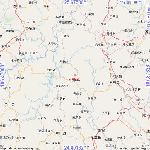
Liupai GPS coordinates[2]
25° 2' 24" North, 107° 10' 23.34" East
| Map corner | latitude | longitude |
|---|---|---|
| Upper-left | 25.67538°, | 106.47003° |
| Center: | 25.04°, | 107.17315° |
| Lower-right: | 24.40132°, | 107.87628° |
| Map W x H: | 141.7×141.7 km | = 88×88mi |
| max Lat: | 53.31946° ⇑86.2% North |
| Liupai: | 25.04° |
| min Lat: | ⇓13.8% South 18.22056° |
| min Long | Liupai | max Long |
| 75.07348° | 107.17315° | 134.28917° |
| W 16.8%⇐ | ⇒83.2% E |
Elevation
Elevation of Liupai is 697 m = 2287 ft, and this is 212.2 m = 696 ft above average elevation for this country.
| Max E: |
5622 m = 18445 ft | 20% |
| Liupai | 697 m 2287 ft | |
| Avg. | 484.8 m = 1591 ft | |
Min E: |
-3 m = -10 ft | 80% |
See also: China elevation on elevation.city.
Geographical zone
Liupai is located in North temperate zone (between Tropic of Cancer and the Arctic Circle). Distance of this Northern Tropic circle is 178.3 km =110.8 mi to South.| Distance of | km | miles | from Liupai |
|---|---|---|---|
| North Pole | 7222.9 | 4488.1 | to North |
| Arctic Circle | 4617 | 2868.9 | to North |
| Tropic Cancer | 178.3 | 110.8 | to South |
| Equator | 2784.2 | 1730 | to South |


Nearby cities:
15 places around Liupai: (largest is in red/bold)
• Baise City
138.9 km =86.3 mi,  204°
204°
• Bama
97 km =60.3 mi,  175°
175°
• Chuanshan
91.7 km =57 mi,  88°
88°
• Donglan
58.4 km =36.3 mi,  158°
158°
• Duyun
140.7 km =87.4 mi,  14°
14°
• Fengcheng
53.8 km =33.4 mi,  194°
194°
• Leli
121 km =75.2 mi,  230°
230°
• Maolan
98.8 km =61.4 mi,  66°
66°
• Nandan Chengguanzhen
38.8 km =24.1 mi, 94°
• Shangjiang
137.4 km =85.4 mi,  43°
43°
• Sicheng
92.5 km =57.5 mi,  220°
220°
• Si’en
112.9 km =70.2 mi,  101°
101°
• Tongle
63.9 km =39.7 mi,  250°
250°
• Xiaoweizhai
132.3 km =82.2 mi, 14°
• Yaolu
99.9 km =62.1 mi,  62°
62°
Sources, notices
• [Note1] Compared only with cities in China existing in our database
• [Src1] Map data: © OpenStreetMap contributors (CC-BY-SA)
• [Src2] Other city data from geonames.org with taken over terms of usage.
• [Src3] Geographical zone / Annual Mean Temperature by Robert A. Rohde @ Wikipedia
