Yongxi geodata
Yongxi (Guizhou) is a populated place; located in China in Asia/Shanghai (GMT+8) time zone. With population of 900 people, there are 1197 cities with bigger population in this country. Compared to other cities in China, 78.6% of cities are located further ↑North; 79.3% of cities are located further →East and 73.7% of cities have lower elevation than Yongxi. Note1


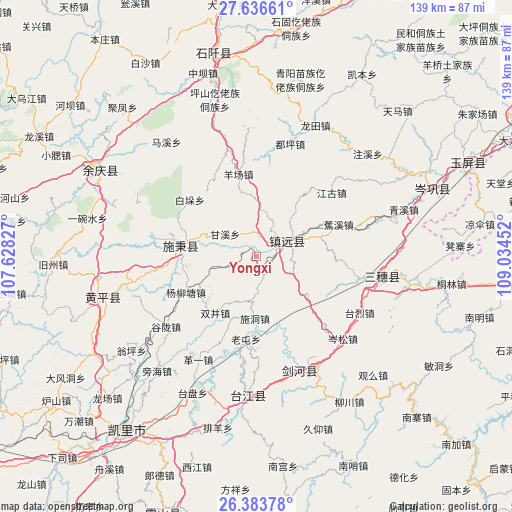
Yongxi GPS coordinates[2]
27° 0' 42.984" North, 108° 19' 53.004" East
| Map corner | latitude | longitude |
|---|---|---|
| Upper-left | 27.63661°, | 107.62827° |
| Center: | 27.01194°, | 108.33139° |
| Lower-right: | 26.38378°, | 109.03452° |
| Map W x H: | 139.3×139.3 km | = 86.6×86.6mi |
| max Lat: | 53.31946° ⇑78.6% North |
| Yongxi: | 27.01194° |
| min Lat: | ⇓21.4% South 18.22056° |
| min Long | Yongxi | max Long |
| 75.07348° | 108.33139° | 134.28917° |
| W 20.7%⇐ | ⇒79.3% E |
Elevation
Elevation of Yongxi is 492 m = 1614 ft, and this is 7.2 m = 24 ft above average elevation for this country.
| Max E: |
5622 m = 18445 ft | 26.3% |
| Yongxi | 492 m 1614 ft | |
| Avg. | 484.8 m = 1591 ft | |
Min E: |
-3 m = -10 ft | 73.7% |
See also: China elevation on elevation.city.
Geographical zone
Yongxi is located in North temperate zone (between Tropic of Cancer and the Arctic Circle). Distance of this Northern Tropic circle is 397.5 km =247 mi to South.| Distance of | km | miles | from Yongxi |
|---|---|---|---|
| North Pole | 7003.6 | 4351.8 | to North |
| Arctic Circle | 4397.7 | 2732.6 | to North |
| Tropic Cancer | 397.5 | 247 | to South |
| Equator | 3003.4 | 1866.2 | to South |


Nearby cities:
15 places around Yongxi: (largest is in red/bold)
• Bangdong
84.8 km =52.7 mi,  92°
92°
• Dabachang
81.2 km =50.5 mi,  0°
0°
• Duping
32 km =19.9 mi,  17°
17°
• Gongxi
83 km =51.6 mi,  82°
82°
• Jiaoxi
23.6 km =14.7 mi,  69°
69°
• Liangsan
63 km =39.1 mi, 81°
• Minhe
73.2 km =45.5 mi,  36°
36°
• Qinglang
41.7 km =25.9 mi, 72°
• Runsong
77.5 km =48.2 mi,  101°
101°
• Shiqian
57.7 km =35.9 mi,  349°
349°
• Siyang
46.6 km =29 mi,  61°
61°
• Xuedong
51.8 km =32.2 mi, 90°
• Yangliugou
67.8 km =42.1 mi, 42°
• Yangping
48.7 km =30.3 mi, 71°
• Zhujiachang
71.3 km =44.3 mi, 57°
Sources, notices
• [Note1] Compared only with cities in China existing in our database
• [Src1] Map data: © OpenStreetMap contributors (CC-BY-SA)
• [Src2] Other city data from geonames.org with taken over terms of usage.
• [Src3] Geographical zone / Annual Mean Temperature by Robert A. Rohde @ Wikipedia
