Yiyang geodata
Yiyang (Hunan) is a seat of a third-order administrative division; located in China in Asia/Shanghai (GMT+8) time zone. In our database, there are 1268 cities with bigger population. Compared to other cities in China, 80.8% of cities are located further ↑North; 60.7% of cities are located further →East and 61.5% of cities have higher elevation than Yiyang. Note1


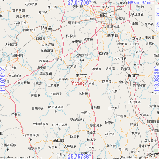
Yiyang GPS coordinates[2]
26° 23' 20.148" North, 112° 22' 45.3" East
| Map corner | latitude | longitude |
|---|---|---|
| Upper-left | 27.01706°, | 111.67613° |
| Center: | 26.38893°, | 112.37925° |
| Lower-right: | 25.75736°, | 113.08238° |
| Map W x H: | 140.1×140.1 km | = 87.1×87.1mi |
| max Lat: | 53.31946° ⇑80.8% North |
| Yiyang: | 26.38893° |
| min Lat: | ⇓19.2% South 18.22056° |
| min Long | Yiyang | max Long |
| 75.07348° | 112.37925° | 134.28917° |
| W 39.3%⇐ | ⇒60.7% E |
Elevation
Elevation of Yiyang is 90 m = 295 ft, and this is 394.8 m = 1295 ft below average elevation for this country.
| Max E: |
5622 m = 18445 ft | 61.5% |
| Avg. | 484.8 m = 1591 ft | |
| Yiyang | 90 m = 295 ft | |
Min E: |
-3 m = -10 ft | 38.5% |
See also: China elevation on elevation.city.
Geographical zone
Yiyang is located in North temperate zone (between Tropic of Cancer and the Arctic Circle). Distance of this Northern Tropic circle is 328.3 km =204 mi to South.| Distance of | km | miles | from Yiyang |
|---|---|---|---|
| North Pole | 7072.9 | 4394.9 | to North |
| Arctic Circle | 4467 | 2775.7 | to North |
| Tropic Cancer | 328.3 | 204 | to South |
| Equator | 2934.2 | 1823.2 | to South |


Nearby cities:
15 places around Yiyang: (largest is in red/bold)
• Bojia
41.9 km =26 mi,  282°
282°
• Hengyang
60.5 km =37.6 mi,  23°
23°
• Hongqiao
50.1 km =31.1 mi,  327°
327°
• Huangtang
51.9 km =32.2 mi,  221°
221°
• Jicun
53 km =32.9 mi,  205°
205°
• Leiyang
47.8 km =29.7 mi,  88°
88°
• Lengshuijing
56.6 km =35.2 mi, 208°
• Lianhua
50.5 km =31.4 mi,  191°
191°
• Longquan
56.7 km =35.2 mi,  197°
197°
• Maojia
64.1 km =39.8 mi, 196°
• Maoli
63.9 km =39.7 mi, 201°
• Menlouxia
45 km =28 mi, 202°
• Wuxi
56.2 km =34.9 mi,  292°
292°
• Xidu
63.1 km =39.2 mi,  359°
359°
• Yunji
44.3 km =27.5 mi,  40°
40°
Sources, notices
• [Note1] Compared only with cities in China existing in our database
• [Src1] Map data: © OpenStreetMap contributors (CC-BY-SA)
• [Src2] Other city data from geonames.org with taken over terms of usage.
• [Src3] Geographical zone / Annual Mean Temperature by Robert A. Rohde @ Wikipedia
