Bada geodata
Bada (Guangxi) is a seat of a third-order administrative division; located in China in Asia/Shanghai (GMT+8) time zone. In our database, there are 1268 cities with bigger population. Compared to other cities in China, 88.1% of cities are located further ↑North; 88.9% of cities are located further →East and 89.3% of cities have lower elevation than Bada. Note1


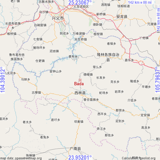
Bada GPS coordinates[2]
24° 35' 34.692" North, 105° 5' 35.664" East
| Map corner | latitude | longitude |
|---|---|---|
| Upper-left | 25.23067°, | 104.39012° |
| Center: | 24.59297°, | 105.09324° |
| Lower-right: | 23.95201°, | 105.79637° |
| Map W x H: | 142.2×142.2 km | = 88.4×88.4mi |
| max Lat: | 53.31946° ⇑88.1% North |
| Bada: | 24.59297° |
| min Lat: | ⇓11.9% South 18.22056° |
| min Long | Bada | max Long |
| 75.07348° | 105.09324° | 134.28917° |
| W 11.1%⇐ | ⇒88.9% E |
Elevation
Elevation of Bada is 1297 m = 4255 ft, and this is 812.2 m = 2665 ft above average elevation for this country.
| Max E: |
5622 m = 18445 ft | 10.7% |
| Bada | 1297 m 4255 ft | |
| Avg. | 484.8 m = 1591 ft | |
Min E: |
-3 m = -10 ft | 89.3% |
See also: China elevation on elevation.city.
Geographical zone
Bada is located in North temperate zone (between Tropic of Cancer and the Arctic Circle). Distance of this Northern Tropic circle is 128.6 km =79.9 mi to South.| Distance of | km | miles | from Bada |
|---|---|---|---|
| North Pole | 7272.6 | 4519 | to North |
| Arctic Circle | 4666.7 | 2899.8 | to North |
| Tropic Cancer | 128.6 | 79.9 | to South |
| Equator | 2734.5 | 1699.1 | to South |


Nearby cities:
15 places around Bada: (largest is in red/bold)
• Danfeng
112.7 km =70 mi,  283°
283°
• Gaojiacun
127.5 km =79.2 mi,  305°
305°
• Jiangna
131.6 km =81.8 mi,  213°
213°
• Jinping
107.8 km =67 mi,  234°
234°
• Leli
119.4 km =74.2 mi,  102°
102°
• Liancheng
60.2 km =37.4 mi,  181°
181°
• Luoxiong
87.2 km =54.2 mi,  291°
291°
• Napo Chengxiangzhen
142.7 km =88.7 mi,  150°
150°
• Sicheng
152 km =94.4 mi, 97°
• Xinhua
119.9 km =74.5 mi, 151°
• Xinzhou
40.5 km =25.2 mi,  39°
39°
• Xisa
133 km =82.6 mi,  197°
197°
• Zhongshu
134.4 km =83.5 mi,  266°
266°
• Zhongshu
152.2 km =94.6 mi, 288°
• Zhong’an
147.5 km =91.7 mi,  324°
324°
Sources, notices
• [Note1] Compared only with cities in China existing in our database
• [Src1] Map data: © OpenStreetMap contributors (CC-BY-SA)
• [Src2] Other city data from geonames.org with taken over terms of usage.
• [Src3] Geographical zone / Annual Mean Temperature by Robert A. Rohde @ Wikipedia
