Luoxiong geodata
Luoxiong (Yunnan) is a seat of a third-order administrative division; located in China in Asia/Shanghai (GMT+8) time zone. In our database, there are 1268 cities with bigger population. Compared to other cities in China, 86.9% of cities are located further ↑North; 89.9% of cities are located further →East and 91.5% of cities have lower elevation than Luoxiong. Note1


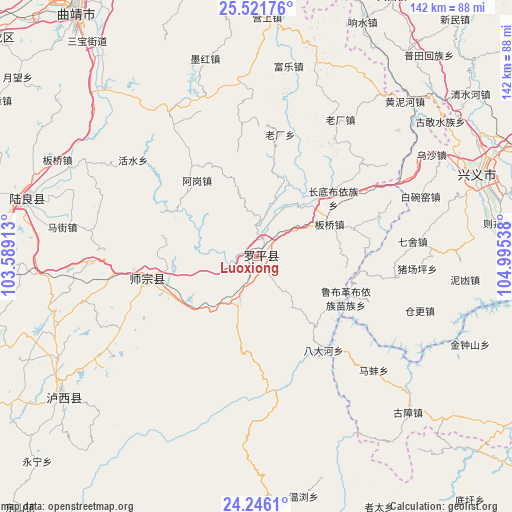
Luoxiong GPS coordinates[2]
24° 53' 8.088" North, 104° 17' 32.1" East
| Map corner | latitude | longitude |
|---|---|---|
| Upper-left | 25.52176°, | 103.58913° |
| Center: | 24.88558°, | 104.29225° |
| Lower-right: | 24.2461°, | 104.99538° |
| Map W x H: | 141.8×141.8 km | = 88.1×88.1mi |
| max Lat: | 53.31946° ⇑86.9% North |
| Luoxiong: | 24.88558° |
| min Lat: | ⇓13.1% South 18.22056° |
| min Long | Luoxiong | max Long |
| 75.07348° | 104.29225° | 134.28917° |
| W 10.1%⇐ | ⇒89.9% E |
Elevation
Elevation of Luoxiong is 1520 m = 4987 ft, and this is 1035.2 m = 3396 ft above average elevation for this country.
| Max E: |
5622 m = 18445 ft | 8.5% |
| Luoxiong | 1520 m 4987 ft | |
| Avg. | 484.8 m = 1591 ft | |
Min E: |
-3 m = -10 ft | 91.5% |
See also: China elevation on elevation.city.
Geographical zone
Luoxiong is located in North temperate zone (between Tropic of Cancer and the Arctic Circle). Distance of this Northern Tropic circle is 161.1 km =100.1 mi to South.| Distance of | km | miles | from Luoxiong |
|---|---|---|---|
| North Pole | 7240 | 4498.7 | to North |
| Arctic Circle | 4634.2 | 2879.6 | to North |
| Tropic Cancer | 161.1 | 100.1 | to South |
| Equator | 2767 | 1719.3 | to South |


Nearby cities:
15 places around Luoxiong: (largest is in red/bold)
• Bada
87.2 km =54.2 mi,  111°
111°
• Beidacun Xiaozhai
94.1 km =58.5 mi,  268°
268°
• Danfeng
29.3 km =18.2 mi,  257°
257°
• Gaojiacun
47.5 km =29.5 mi,  330°
330°
• Huakoulongtan
98.5 km =61.2 mi,  244°
244°
• Jinping
95.3 km =59.2 mi,  183°
183°
• Pingpo
81.1 km =50.4 mi,  318°
318°
• Qujing
83.9 km =52.1 mi, 322°
• Shilin
97.1 km =60.3 mi, 265°
• Tongquan
92.8 km =57.7 mi,  308°
308°
• Weize
91.7 km =57 mi, 257°
• Xiping
93.6 km =58.2 mi, 327°
• Zhongshu
65.4 km =40.6 mi,  283°
283°
• Zhongshu
67.1 km =41.7 mi,  232°
232°
• Zhong’an
87.1 km =54.1 mi,  356°
356°
Sources, notices
• [Note1] Compared only with cities in China existing in our database
• [Src1] Map data: © OpenStreetMap contributors (CC-BY-SA)
• [Src2] Other city data from geonames.org with taken over terms of usage.
• [Src3] Geographical zone / Annual Mean Temperature by Robert A. Rohde @ Wikipedia
