Yangjiao geodata
Yangjiao (Hebei) is a seat of a fourth-order administrative division; located in China in Asia/Shanghai (GMT+8) time zone. In our database, there are 1268 cities with bigger population. Compared to other cities in China, 82.7% of cities are located further ↓South; 52.6% of cities are located further ←West and 65.1% of cities have lower elevation than Yangjiao. Note1


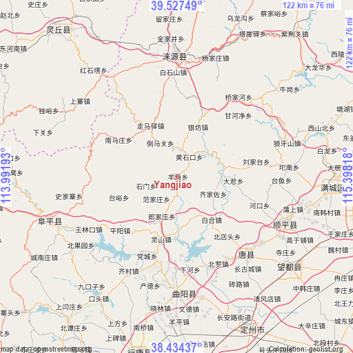
Yangjiao GPS coordinates[2]
38° 58' 58.944" North, 114° 41' 42.18" East
| Map corner | latitude | longitude |
|---|---|---|
| Upper-left | 39.52749°, | 113.99193° |
| Center: | 38.98304°, | 114.69505° |
| Lower-right: | 38.43437°, | 115.39818° |
| Map W x H: | 121.5×121.5 km | = 75.5×75.5mi |
| max Lat: | 53.31946° ⇑17.3% North |
| Yangjiao: | 38.98304° |
| min Lat: | ⇓82.7% South 18.22056° |
| min Long | Yangjiao | max Long |
| 75.07348° | 114.69505° | 134.28917° |
| W 52.6%⇐ | ⇒47.4% E |
Elevation
Elevation of Yangjiao is 327 m = 1073 ft, and this is 157.8 m = 518 ft below average elevation for this country.
| Max E: |
5622 m = 18445 ft | 34.9% |
| Avg. | 484.8 m = 1591 ft | |
| Yangjiao | 327 m = 1073 ft | |
Min E: |
-3 m = -10 ft | 65.1% |
See also: China elevation on elevation.city.
Geographical zone
Yangjiao is located in North temperate zone (between Tropic of Cancer and the Arctic Circle). Distance of this Northern Tropic circle is 1728.6 km =1074.1 mi to South.| Distance of | km | miles | from Yangjiao |
|---|---|---|---|
| North Pole | 5672.6 | 3524.8 | to North |
| Arctic Circle | 3066.7 | 1905.6 | to North |
| Tropic Cancer | 1728.6 | 1074.1 | to South |
| Equator | 4334.5 | 2693.3 | to South |


Nearby cities:
15 places around Yangjiao: (largest is in red/bold)
• Baihe
18.8 km =11.7 mi,  140°
140°
• Beidiantou
26.9 km =16.7 mi, 140°
• Beitai
19.3 km =12 mi,  220°
220°
• Dabei
19.7 km =12.2 mi,  93°
93°
• Dayang
25.1 km =15.6 mi,  159°
159°
• Fanjiazhuang
10.5 km =6.5 mi, 223°
• Juncheng
5.6 km =3.5 mi,  178°
178°
• Langjiazhuang
14.3 km =8.9 mi,  200°
200°
• Lingshan
22.1 km =13.7 mi,  193°
193°
• Micheng
14.9 km =9.3 mi,  153°
153°
• Pingyang
26.8 km =16.7 mi,  226°
226°
• Qijiazuo
13.7 km =8.5 mi,  114°
114°
• Shennan
16.1 km =10 mi, 86°
• Shimen
10.9 km =6.8 mi,  254°
254°
• Taiyu
20.9 km =13 mi, 250°
Sources, notices
• [Note1] Compared only with cities in China existing in our database
• [Src1] Map data: © OpenStreetMap contributors (CC-BY-SA)
• [Src2] Other city data from geonames.org with taken over terms of usage.
• [Src3] Geographical zone / Annual Mean Temperature by Robert A. Rohde @ Wikipedia
