Shimen geodata
Shimen (Hebei) is a seat of a fourth-order administrative division; located in China in Asia/Shanghai (GMT+8) time zone. In our database, there are 1268 cities with bigger population. Compared to other cities in China, 82.6% of cities are located further ↓South; 51.9% of cities are located further ←West and 66.6% of cities have lower elevation than Shimen. Note1


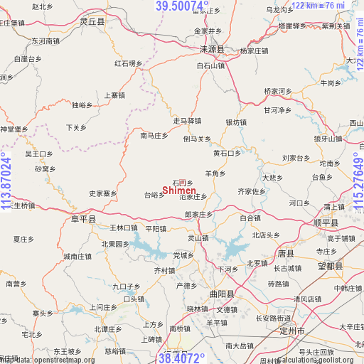
Shimen GPS coordinates[2]
38° 57' 21.888" North, 114° 34' 24.096" East
| Map corner | latitude | longitude |
|---|---|---|
| Upper-left | 39.50074°, | 113.87024° |
| Center: | 38.95608°, | 114.57336° |
| Lower-right: | 38.4072°, | 115.27649° |
| Map W x H: | 121.6×121.6 km | = 75.6×75.6mi |
| max Lat: | 53.31946° ⇑17.4% North |
| Shimen: | 38.95608° |
| min Lat: | ⇓82.6% South 18.22056° |
| min Long | Shimen | max Long |
| 75.07348° | 114.57336° | 134.28917° |
| W 51.9%⇐ | ⇒48.1% E |
Elevation
Elevation of Shimen is 354 m = 1161 ft, and this is 130.8 m = 429 ft below average elevation for this country.
| Max E: |
5622 m = 18445 ft | 33.4% |
| Avg. | 484.8 m = 1591 ft | |
| Shimen | 354 m = 1161 ft | |
Min E: |
-3 m = -10 ft | 66.6% |
See also: China elevation on elevation.city.
Geographical zone
Shimen is located in North temperate zone (between Tropic of Cancer and the Arctic Circle). Distance of this Northern Tropic circle is 1725.6 km =1072.2 mi to South.| Distance of | km | miles | from Shimen |
|---|---|---|---|
| North Pole | 5675.6 | 3526.7 | to North |
| Arctic Circle | 3069.7 | 1907.4 | to North |
| Tropic Cancer | 1725.6 | 1072.2 | to South |
| Equator | 4331.5 | 2691.5 | to South |


Nearby cities:
15 places around Shimen: (largest is in red/bold)
• Baihe
25.2 km =15.7 mi,  117°
117°
• Beitai
11.8 km =7.3 mi,  189°
189°
• Dangcheng
24.4 km =15.2 mi,  180°
180°
• Datai
17.6 km =10.9 mi,  279°
279°
• Fanjiazhuang
5.6 km =3.5 mi,  144°
144°
• Juncheng
11 km =6.8 mi,  103°
103°
• Langjiazhuang
11.7 km =7.3 mi,  152°
152°
• Lingshan
19.2 km =11.9 mi,  163°
163°
• Micheng
20 km =12.4 mi, 120°
• Pingyang
17.8 km =11.1 mi,  210°
210°
• Qijiazuo
23.1 km =14.4 mi, 96°
• Shijiazhai
26.8 km =16.7 mi,  262°
262°
• Taiyu
10 km =6.2 mi,  246°
246°
• Wanglinkou
24.9 km =15.5 mi,  233°
233°
• Yangjiao
10.9 km =6.8 mi,  74°
74°
Sources, notices
• [Note1] Compared only with cities in China existing in our database
• [Src1] Map data: © OpenStreetMap contributors (CC-BY-SA)
• [Src2] Other city data from geonames.org with taken over terms of usage.
• [Src3] Geographical zone / Annual Mean Temperature by Robert A. Rohde @ Wikipedia
