Lixiqiao geodata
Lixiqiao (Hunan) is a populated place; located in China in Asia/Shanghai (GMT+8) time zone. With population of 1,960 people, there are 1038 cities with bigger population in this country. Compared to other cities in China, 79.4% of cities are located further ↑North; 69.4% of cities are located further →East and 70.1% of cities have lower elevation than Lixiqiao. Note1


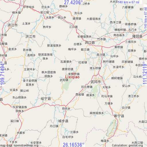
Lixiqiao GPS coordinates[2]
26° 47' 40.992" North, 110° 25' 5.016" East
| Map corner | latitude | longitude |
|---|---|---|
| Upper-left | 27.4206°, | 109.71494° |
| Center: | 26.79472°, | 110.41806° |
| Lower-right: | 26.16536°, | 111.12119° |
| Map W x H: | 139.6×139.6 km | = 86.7×86.7mi |
| max Lat: | 53.31946° ⇑79.4% North |
| Lixiqiao: | 26.79472° |
| min Lat: | ⇓20.6% South 18.22056° |
| min Long | Lixiqiao | max Long |
| 75.07348° | 110.41806° | 134.28917° |
| W 30.6%⇐ | ⇒69.4% E |
Elevation
Elevation of Lixiqiao is 414 m = 1358 ft, and this is 70.8 m = 232 ft below average elevation for this country.
| Max E: |
5622 m = 18445 ft | 29.9% |
| Avg. | 484.8 m = 1591 ft | |
| Lixiqiao | 414 m = 1358 ft | |
Min E: |
-3 m = -10 ft | 70.1% |
See also: China elevation on elevation.city.
Geographical zone
Lixiqiao is located in North temperate zone (between Tropic of Cancer and the Arctic Circle). Distance of this Northern Tropic circle is 373.4 km =232 mi to South.| Distance of | km | miles | from Lixiqiao |
|---|---|---|---|
| North Pole | 7027.8 | 4366.9 | to North |
| Arctic Circle | 4421.9 | 2747.6 | to North |
| Tropic Cancer | 373.4 | 232 | to South |
| Equator | 2979.3 | 1851.3 | to South |


Nearby cities:
15 places around Lixiqiao: (largest is in red/bold)
• Changpu
39.3 km =24.4 mi,  231°
231°
• Dengyuantai
17.1 km =10.6 mi,  133°
133°
• Dongkou
31 km =19.3 mi,  22°
22°
• Guanxia Miaozuxiang
28.5 km =17.7 mi,  209°
209°
• Hekou
35.6 km =22.1 mi,  260°
260°
• Huangtukuang
13.4 km =8.3 mi,  355°
355°
• Huayuan
17.6 km =10.9 mi,  41°
41°
• Jiangfang
33.4 km =20.8 mi,  192°
192°
• Maoping
30.6 km =19 mi,  181°
181°
• Ma’an
36.3 km =22.6 mi,  55°
55°
• Tangjiafang
7.3 km =4.5 mi,  313°
313°
• Wantouqiao
20.6 km =12.8 mi,  75°
75°
• Wuyang
10.6 km =6.6 mi,  237°
237°
• Xiyan
20.6 km =12.8 mi,  164°
164°
• Zhuzhoujiang Miaozuxiang
36.8 km =22.9 mi,  248°
248°
Sources, notices
• [Note1] Compared only with cities in China existing in our database
• [Src1] Map data: © OpenStreetMap contributors (CC-BY-SA)
• [Src2] Other city data from geonames.org with taken over terms of usage.
• [Src3] Geographical zone / Annual Mean Temperature by Robert A. Rohde @ Wikipedia
