Huangtukuang geodata
Huangtukuang (Hunan) is a populated place; located in China in Asia/Shanghai (GMT+8) time zone. With population of 1,990 people, there are 1034 cities with bigger population in this country. Compared to other cities in China, 79% of cities are located further ↑North; 69.5% of cities are located further →East and 70.9% of cities have lower elevation than Huangtukuang. Note1


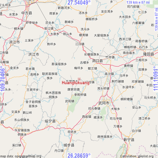
Huangtukuang GPS coordinates[2]
26° 54' 55.008" North, 110° 24' 28.008" East
| Map corner | latitude | longitude |
|---|---|---|
| Upper-left | 27.54049°, | 109.70466° |
| Center: | 26.91528°, | 110.40778° |
| Lower-right: | 26.28659°, | 111.11091° |
| Map W x H: | 139.4×139.4 km | = 86.6×86.6mi |
| max Lat: | 53.31946° ⇑79% North |
| Huangtukuang: | 26.91528° |
| min Lat: | ⇓21% South 18.22056° |
| min Long | Huangtukuang | max Long |
| 75.07348° | 110.40778° | 134.28917° |
| W 30.5%⇐ | ⇒69.5% E |
Elevation
Elevation of Huangtukuang is 427 m = 1401 ft, and this is 57.8 m = 190 ft below average elevation for this country.
| Max E: |
5622 m = 18445 ft | 29.1% |
| Avg. | 484.8 m = 1591 ft | |
| Huangtukuang | 427 m = 1401 ft | |
Min E: |
-3 m = -10 ft | 70.9% |
See also: China elevation on elevation.city.
Geographical zone
Huangtukuang is located in North temperate zone (between Tropic of Cancer and the Arctic Circle). Distance of this Northern Tropic circle is 386.8 km =240.3 mi to South.| Distance of | km | miles | from Huangtukuang |
|---|---|---|---|
| North Pole | 7014.4 | 4358.5 | to North |
| Arctic Circle | 4408.5 | 2739.3 | to North |
| Tropic Cancer | 386.8 | 240.3 | to South |
| Equator | 2992.7 | 1859.6 | to South |


Nearby cities:
15 places around Huangtukuang: (largest is in red/bold)
• Dengyuantai
28.6 km =17.8 mi,  152°
152°
• Dongkou
19.9 km =12.4 mi,  39°
39°
• Gaoyi
39.2 km =24.4 mi,  277°
277°
• Guanxia Miaozuxiang
40.3 km =25 mi,  198°
198°
• Hekou
39.2 km =24.4 mi,  240°
240°
• Huayuan
12.7 km =7.9 mi,  90°
90°
• Jiangkou
30.6 km =19 mi,  359°
359°
• Lixiqiao
13.4 km =8.3 mi,  175°
175°
• Ma’an
31.8 km =19.8 mi,  77°
77°
• Shuping
41.1 km =25.5 mi,  318°
318°
• Tangjiafang
9.4 km =5.8 mi,  207°
207°
• Wantouqiao
22.6 km =14 mi,  111°
111°
• Wuyang
20.7 km =12.9 mi, 202°
• Xiyan
33.9 km =21.1 mi,  168°
168°
• Zhushi
32.8 km =20.4 mi,  54°
54°
Sources, notices
• [Note1] Compared only with cities in China existing in our database
• [Src1] Map data: © OpenStreetMap contributors (CC-BY-SA)
• [Src2] Other city data from geonames.org with taken over terms of usage.
• [Src3] Geographical zone / Annual Mean Temperature by Robert A. Rohde @ Wikipedia
