Xifeng geodata
Xifeng (Liaoning) is a populated place; located in China in Asia/Shanghai (GMT+8) time zone. With population of 61,087 people, there are 715 cities with bigger population in this country. Compared to other cities in China, 91.6% of cities are located further ↓South; 94.5% of cities are located further ←West and 54% of cities have lower elevation than Xifeng. Note1


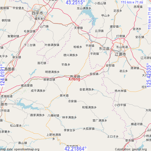
Xifeng GPS coordinates[2]
42° 44' 13.992" North, 124° 43' 19.992" East
| Map corner | latitude | longitude |
|---|---|---|
| Upper-left | 43.2515°, | 124.0191° |
| Center: | 42.73722°, | 124.72222° |
| Lower-right: | 42.21864°, | 125.42535° |
| Map W x H: | 114.8×114.8 km | = 71.3×71.3mi |
| max Lat: | 53.31946° ⇑8.4% North |
| Xifeng: | 42.73722° |
| min Lat: | ⇓91.6% South 18.22056° |
| min Long | Xifeng | max Long |
| 75.07348° | 124.72222° | 134.28917° |
| W 94.5%⇐ | ⇒5.5% E |
Elevation
Elevation of Xifeng is 197 m = 646 ft, and this is 287.8 m = 944 ft below average elevation for this country.
| Max E: |
5622 m = 18445 ft | 46% |
| Avg. | 484.8 m = 1591 ft | |
| Xifeng | 197 m = 646 ft | |
Min E: |
-3 m = -10 ft | 54% |
See also: Xifeng elevation on elevation.city.
Geographical zone
Xifeng is located in North temperate zone (between Tropic of Cancer and the Arctic Circle). Distance of this Northern Tropic circle is 2146 km =1333.5 mi to South.| Distance of | km | miles | from Xifeng |
|---|---|---|---|
| North Pole | 5255.1 | 3265.4 | to North |
| Arctic Circle | 2649.2 | 1646.1 | to North |
| Tropic Cancer | 2146 | 1333.5 | to South |
| Equator | 4751.9 | 2952.7 | to South |


Nearby cities:
15 places around Xifeng: (largest is in red/bold)
• Baiquan
25.3 km =15.7 mi,  49°
49°
• Changtu
51.4 km =31.9 mi,  275°
275°
• Dongfeng
65.4 km =40.6 mi,  99°
99°
• Ertaizi
56.7 km =35.2 mi,  285°
285°
• Kaiyuan
60.2 km =37.4 mi,  247°
247°
• Laocheng
59.7 km =37.1 mi,  274°
274°
• Liaoyuan
38.5 km =23.9 mi,  61°
61°
• Lishu
70.8 km =44 mi,  333°
333°
• Maojiadian
48.7 km =30.3 mi,  314°
314°
• Mazhonghe
57.1 km =35.5 mi, 267°
• Qiujia
67.7 km =42.1 mi, 308°
• Quangou
62.1 km =38.6 mi,  322°
322°
• Quantou
47.2 km =29.3 mi, 287°
• Siping
54.9 km =34.1 mi, 329°
• Xia’ertai
42.3 km =26.3 mi,  303°
303°
Sources, notices
• [Note1] Compared only with cities in China existing in our database
• [Src1] Map data: © OpenStreetMap contributors (CC-BY-SA)
• [Src2] Other city data from geonames.org with taken over terms of usage.
• [Src3] Geographical zone / Annual Mean Temperature by Robert A. Rohde @ Wikipedia
