Liaoyuan geodata
Liaoyuan (Jilin) is a populated place; located in China in Asia/Shanghai (GMT+8) time zone. With population of 465,249 people, there are 137 cities with bigger population in this country. Compared to other cities in China, 91.9% of cities are located further ↓South; 94.8% of cities are located further ←West and 60.3% of cities have lower elevation than Liaoyuan. Note1


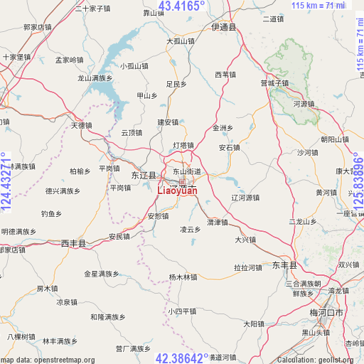
Liaoyuan GPS coordinates[2]
42° 54' 12.996" North, 125° 8' 8.988" East
| Map corner | latitude | longitude |
|---|---|---|
| Upper-left | 43.4165°, | 124.43271° |
| Center: | 42.90361°, | 125.13583° |
| Lower-right: | 42.38642°, | 125.83896° |
| Map W x H: | 114.5×114.5 km | = 71.1×71.1mi |
| max Lat: | 53.31946° ⇑8.1% North |
| Liaoyuan: | 42.90361° |
| min Lat: | ⇓91.9% South 18.22056° |
| min Long | Liaoyuan | max Long |
| 75.07348° | 125.13583° | 134.28917° |
| W 94.8%⇐ | ⇒5.2% E |
Elevation
Elevation of Liaoyuan is 263 m = 863 ft, and this is 221.8 m = 728 ft below average elevation for this country.
| Max E: |
5622 m = 18445 ft | 39.7% |
| Avg. | 484.8 m = 1591 ft | |
| Liaoyuan | 263 m = 863 ft | |
Min E: |
-3 m = -10 ft | 60.3% |
See also: Liaoyuan elevation on elevation.city.
Geographical zone
Liaoyuan is located in North temperate zone (between Tropic of Cancer and the Arctic Circle). Distance of this Northern Tropic circle is 2164.5 km =1345 mi to South.| Distance of | km | miles | from Liaoyuan |
|---|---|---|---|
| North Pole | 5236.6 | 3253.9 | to North |
| Arctic Circle | 2630.7 | 1634.6 | to North |
| Tropic Cancer | 2164.5 | 1345 | to South |
| Equator | 4770.4 | 2964.2 | to South |


Nearby cities:
15 places around Liaoyuan: (largest is in red/bold)
• Baiquan
14.6 km =9.1 mi,  262°
262°
• Chaoyang
77.5 km =48.2 mi,  110°
110°
• Dongfeng
42.4 km =26.3 mi,  133°
133°
• Gongzhuling
71.2 km =44.2 mi,  338°
338°
• Lishu
79.3 km =49.3 mi,  304°
304°
• Maojiadian
70.3 km =43.7 mi,  282°
282°
• Meihekou
60.8 km =37.8 mi, 133°
• Panshi
75.1 km =46.7 mi,  86°
86°
• Quangou
77.5 km =48.2 mi,  293°
293°
• Quantou
78.8 km =49 mi,  266°
266°
• Shuangyang
81.6 km =50.7 mi,  32°
32°
• Siping
67.9 km =42.2 mi, 294°
• Xia’ertai
68.9 km =42.8 mi, 274°
• Xifeng
38.5 km =23.9 mi,  241°
241°
• Yitong
48.8 km =30.3 mi,  15°
15°
Sources, notices
• [Note1] Compared only with cities in China existing in our database
• [Src1] Map data: © OpenStreetMap contributors (CC-BY-SA)
• [Src2] Other city data from geonames.org with taken over terms of usage.
• [Src3] Geographical zone / Annual Mean Temperature by Robert A. Rohde @ Wikipedia
