Shuangyashan geodata
Shuangyashan (Heilongjiang) is a populated place; located in China in Asia/Shanghai (GMT+8) time zone. With population of 600,000 people, there are 109 cities with bigger population in this country. Compared to other cities in China, 96.1% of cities are located further ↓South; 100% of cities are located further ←West and 54.3% of cities have lower elevation than Shuangyashan. Note1


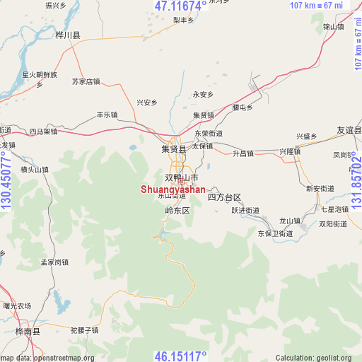
Shuangyashan GPS coordinates[2]
46° 38' 9.996" North, 131° 9' 14.004" East
| Map corner | latitude | longitude |
|---|---|---|
| Upper-left | 47.11674°, | 130.45077° |
| Center: | 46.63611°, | 131.15389° |
| Lower-right: | 46.15117°, | 131.85702° |
| Map W x H: | 107.4×107.4 km | = 66.7×66.7mi |
| max Lat: | 53.31946° ⇑3.9% North |
| Shuangyashan: | 46.63611° |
| min Lat: | ⇓96.1% South 18.22056° |
| min Long | Shuangyashan | max Long |
| 75.07348° | 131.15389° | 134.28917° |
| W 100%⇐ | ⇒0% E |
Elevation
Elevation of Shuangyashan is 200 m = 656 ft, and this is 284.8 m = 934 ft below average elevation for this country.
| Max E: |
5622 m = 18445 ft | 45.7% |
| Avg. | 484.8 m = 1591 ft | |
| Shuangyashan | 200 m = 656 ft | |
Min E: |
-3 m = -10 ft | 54.3% |
See also: Shuangyashan elevation on elevation.city.
Geographical zone
Shuangyashan is located in North temperate zone (between Tropic of Cancer and the Arctic Circle). Distance of this North polar circle is 2215.7 km =1376.8 mi to North.| Distance of | km | miles | from Shuangyashan |
|---|---|---|---|
| North Pole | 4821.6 | 2996 | to North |
| Arctic Circle | 2215.7 | 1376.8 | to North |
| Tropic Cancer | 2579.5 | 1602.8 | to South |
| Equator | 5185.4 | 3222.1 | to South |


Nearby cities:
15 places around Shuangyashan: (largest is in red/bold)
• Baoshan
22.4 km =13.9 mi,  112°
112°
• Changfa
53.4 km =33.2 mi,  281°
281°
• Chuangye
49.7 km =30.9 mi,  308°
308°
• Fengle
29.7 km =18.5 mi, 311°
• Fuli
9.6 km =6 mi,  353°
353°
• Hengtoushan
43.7 km =27.2 mi,  274°
274°
• Jianguo
53.3 km =33.1 mi,  300°
300°
• Lingdong
7.7 km =4.8 mi,  184°
184°
• Mengjiagang
44.6 km =27.7 mi,  237°
237°
• Simajia
43.6 km =27.1 mi,  290°
290°
• Sujiadian
41.1 km =25.5 mi,  316°
316°
• Taiping
37.4 km =23.2 mi, 291°
• Tuoyaozi
52.8 km =32.8 mi,  213°
213°
• Xinghuo
51.9 km =32.2 mi, 306°
• Yuelai
54.6 km =33.9 mi, 322°
Sources, notices
• [Note1] Compared only with cities in China existing in our database
• [Src1] Map data: © OpenStreetMap contributors (CC-BY-SA)
• [Src2] Other city data from geonames.org with taken over terms of usage.
• [Src3] Geographical zone / Annual Mean Temperature by Robert A. Rohde @ Wikipedia
