Shuanggang geodata
Shuanggang (Jilin) is a seat of a fourth-order administrative division; located in China in Asia/Shanghai (GMT+8) time zone. In our database, there are 1268 cities with bigger population. Compared to other cities in China, 93.9% of cities are located further ↓South; 92.6% of cities are located further ←West and 52.6% of cities have higher elevation than Shuanggang. Note1


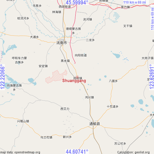
Shuanggang GPS coordinates[2]
45° 6' 20.988" North, 122° 55' 25.608" East
| Map corner | latitude | longitude |
|---|---|---|
| Upper-left | 45.59994°, | 122.22066° |
| Center: | 45.10583°, | 122.92378° |
| Lower-right: | 44.60741°, | 123.62691° |
| Map W x H: | 110.4×110.4 km | = 68.6×68.6mi |
| max Lat: | 53.31946° ⇑6.1% North |
| Shuanggang: | 45.10583° |
| min Lat: | ⇓93.9% South 18.22056° |
| min Long | Shuanggang | max Long |
| 75.07348° | 122.92378° | 134.28917° |
| W 92.6%⇐ | ⇒7.4% E |
Elevation
Elevation of Shuanggang is 146 m = 479 ft, and this is 338.8 m = 1112 ft below average elevation for this country.
| Max E: |
5622 m = 18445 ft | 52.6% |
| Avg. | 484.8 m = 1591 ft | |
| Shuanggang | 146 m = 479 ft | |
Min E: |
-3 m = -10 ft | 47.4% |
See also: China elevation on elevation.city.
Geographical zone
Shuanggang is located in North temperate zone (between Tropic of Cancer and the Arctic Circle). Distance of this North polar circle is 2385.9 km =1482.5 mi to North.| Distance of | km | miles | from Shuanggang |
|---|---|---|---|
| North Pole | 4991.8 | 3101.8 | to North |
| Arctic Circle | 2385.9 | 1482.5 | to North |
| Tropic Cancer | 2409.4 | 1497.1 | to South |
| Equator | 5015.3 | 3116.4 | to South |


Nearby cities:
15 places around Shuanggang: (largest is in red/bold)
• Anding
26.3 km =16.3 mi,  284°
284°
• Baicheng
56.4 km =35 mi,  351°
351°
• Deshun
34.4 km =21.4 mi, 353°
• Guangming
27.6 km =17.1 mi,  336°
336°
• Heishui
13.4 km =8.3 mi,  321°
321°
• Kaitong
37.1 km =23.1 mi,  151°
151°
• Linhai
47.9 km =29.8 mi, 343°
• Mingren
54.8 km =34.1 mi, 351°
• Pingtai
71.2 km =44.2 mi, 342°
• Qingshan
70.4 km =43.7 mi,  356°
356°
• Taodong
59 km =36.7 mi,  330°
330°
• Xi Ail
24.9 km =15.5 mi,  203°
203°
• Xianghai
45.8 km =28.5 mi,  259°
259°
• Xinfa
69.1 km =42.9 mi,  212°
212°
• Xinhua
58.3 km =36.2 mi,  184°
184°
Sources, notices
• [Note1] Compared only with cities in China existing in our database
• [Src1] Map data: © OpenStreetMap contributors (CC-BY-SA)
• [Src2] Other city data from geonames.org with taken over terms of usage.
• [Src3] Geographical zone / Annual Mean Temperature by Robert A. Rohde @ Wikipedia
