Chaigoubu geodata
Chaigoubu (Hebei) is a seat of a third-order administrative division; located in China in Asia/Shanghai (GMT+8) time zone. In our database, there are 1268 cities with bigger population. Compared to other cities in China, 88.4% of cities are located further ↓South; 51% of cities are located further ←West and 82.2% of cities have lower elevation than Chaigoubu. Note1


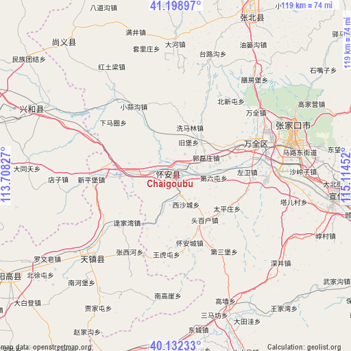
Chaigoubu GPS coordinates[2]
40° 40' 4.008" North, 114° 24' 41.004" East
| Map corner | latitude | longitude |
|---|---|---|
| Upper-left | 41.19897°, | 113.70827° |
| Center: | 40.66778°, | 114.41139° |
| Lower-right: | 40.13233°, | 115.11452° |
| Map W x H: | 118.6×118.6 km | = 73.7×73.7mi |
| max Lat: | 53.31946° ⇑11.6% North |
| Chaigoubu: | 40.66778° |
| min Lat: | ⇓88.4% South 18.22056° |
| min Long | Chaigoubu | max Long |
| 75.07348° | 114.41139° | 134.28917° |
| W 51%⇐ | ⇒49% E |
Elevation
Elevation of Chaigoubu is 799 m = 2621 ft, and this is 314.2 m = 1031 ft above average elevation for this country.
| Max E: |
5622 m = 18445 ft | 17.8% |
| Chaigoubu | 799 m 2621 ft | |
| Avg. | 484.8 m = 1591 ft | |
Min E: |
-3 m = -10 ft | 82.2% |
See also: China elevation on elevation.city.
Geographical zone
Chaigoubu is located in North temperate zone (between Tropic of Cancer and the Arctic Circle). Distance of this Northern Tropic circle is 1915.9 km =1190.5 mi to South.| Distance of | km | miles | from Chaigoubu |
|---|---|---|---|
| North Pole | 5485.2 | 3408.3 | to North |
| Arctic Circle | 2879.3 | 1789.1 | to North |
| Tropic Cancer | 1915.9 | 1190.5 | to South |
| Equator | 4521.8 | 2809.7 | to South |


Nearby cities:
15 places around Chaigoubu: (largest is in red/bold)
• Aoshi
86.6 km =53.8 mi,  205°
205°
• Chengzhen
75.3 km =46.8 mi,  106°
106°
• Kongjiazhuang
28.1 km =17.5 mi,  70°
70°
• Longquan
71.5 km =44.4 mi,  241°
241°
• Nanhaoqian
58.5 km =36.4 mi,  319°
319°
• Taohua
84.8 km =52.7 mi,  142°
142°
• Xibali
82.6 km =51.3 mi, 106°
• Xicheng
65.5 km =40.7 mi,  199°
199°
• Xinghe Chengguanzhen
50.1 km =31.1 mi,  297°
297°
• Xiwanzi
79.9 km =49.6 mi, 65°
• Yuquan
44.6 km =27.7 mi, 235°
• Zhangbei
59.4 km =36.9 mi,  24°
24°
• Zhangjiakou
42.5 km =26.4 mi, 68°
• Zhangjiakou Shi Xuanhua Qu
53.8 km =33.4 mi,  96°
96°
• Zhuolu
75.7 km =47 mi,  115°
115°
Sources, notices
• [Note1] Compared only with cities in China existing in our database
• [Src1] Map data: © OpenStreetMap contributors (CC-BY-SA)
• [Src2] Other city data from geonames.org with taken over terms of usage.
• [Src3] Geographical zone / Annual Mean Temperature by Robert A. Rohde @ Wikipedia
