Zhangbei geodata
Zhangbei (Hebei) is a seat of a third-order administrative division; located in China in Asia/Shanghai (GMT+8) time zone. In our database, there are 1268 cities with bigger population. Compared to other cities in China, 89.5% of cities are located further ↓South; 52.7% of cities are located further ←West and 90.4% of cities have lower elevation than Zhangbei. Note1


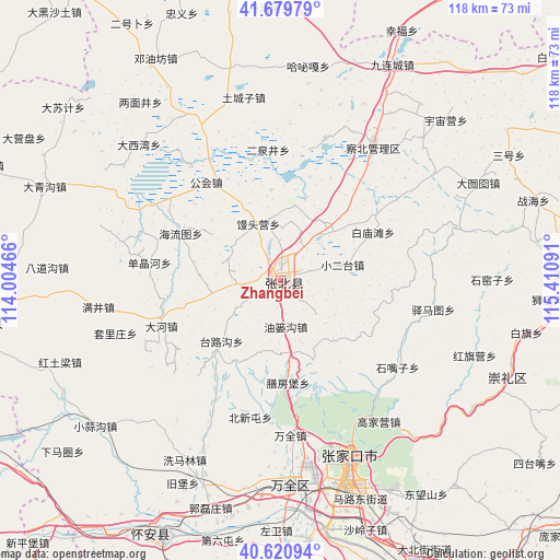
Zhangbei GPS coordinates[2]
41° 9' 9" North, 114° 42' 28.008" East
| Map corner | latitude | longitude |
|---|---|---|
| Upper-left | 41.67979°, | 114.00466° |
| Center: | 41.1525°, | 114.70778° |
| Lower-right: | 40.62094°, | 115.41091° |
| Map W x H: | 117.7×117.7 km | = 73.1×73.1mi |
| max Lat: | 53.31946° ⇑10.5% North |
| Zhangbei: | 41.1525° |
| min Lat: | ⇓89.5% South 18.22056° |
| min Long | Zhangbei | max Long |
| 75.07348° | 114.70778° | 134.28917° |
| W 52.7%⇐ | ⇒47.3% E |
Elevation
Elevation of Zhangbei is 1396 m = 4580 ft, and this is 911.2 m = 2990 ft above average elevation for this country.
| Max E: |
5622 m = 18445 ft | 9.6% |
| Zhangbei | 1396 m 4580 ft | |
| Avg. | 484.8 m = 1591 ft | |
Min E: |
-3 m = -10 ft | 90.4% |
See also: China elevation on elevation.city.
Geographical zone
Zhangbei is located in North temperate zone (between Tropic of Cancer and the Arctic Circle). Distance of this Northern Tropic circle is 1969.8 km =1224 mi to South.| Distance of | km | miles | from Zhangbei |
|---|---|---|---|
| North Pole | 5431.3 | 3374.9 | to North |
| Arctic Circle | 2825.4 | 1755.6 | to North |
| Tropic Cancer | 1969.8 | 1224 | to South |
| Equator | 4575.7 | 2843.2 | to South |


Nearby cities:
15 places around Zhangbei: (largest is in red/bold)
• Baochang
94.3 km =58.6 mi,  30°
30°
• Chaigoubu
59.4 km =36.9 mi,  204°
204°
• Chengzhen
88.4 km =54.9 mi,  147°
147°
• Chicheng
99.6 km =61.9 mi,  108°
108°
• Kangbao
77.5 km =48.2 mi,  354°
354°
• Kongjiazhuang
44.5 km =27.7 mi,  178°
178°
• Nanhaoqian
63.3 km =39.3 mi,  261°
261°
• Pingdingbu
100.3 km =62.3 mi,  55°
55°
• Xibali
94.5 km =58.7 mi, 145°
• Xinghe Chengguanzhen
75.7 km =47 mi,  245°
245°
• Xiwanzi
51.4 km =31.9 mi, 113°
• Yuquan
100.2 km =62.3 mi,  218°
218°
• Zhangjiakou
40.7 km =25.3 mi,  159°
159°
• Zhangjiakou Shi Xuanhua Qu
66.6 km =41.4 mi, 154°
• Zhuolu
97 km =60.3 mi, 153°
Sources, notices
• [Note1] Compared only with cities in China existing in our database
• [Src1] Map data: © OpenStreetMap contributors (CC-BY-SA)
• [Src2] Other city data from geonames.org with taken over terms of usage.
• [Src3] Geographical zone / Annual Mean Temperature by Robert A. Rohde @ Wikipedia
