Zhangjiakou geodata
Zhangjiakou (Hebei) is a populated place; located in China in Asia/Shanghai (GMT+8) time zone. With population of 692,602 people, there are 89 cities with bigger population in this country. Compared to other cities in China, 88.8% of cities are located further ↓South; 53.6% of cities are located further ←West and 81.3% of cities have lower elevation than Zhangjiakou. Note1


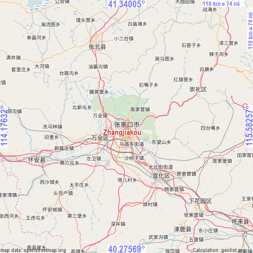
Zhangjiakou GPS coordinates[2]
40° 48' 36" North, 114° 52' 45.984" East
| Map corner | latitude | longitude |
|---|---|---|
| Upper-left | 41.34005°, | 114.17632° |
| Center: | 40.81°, | 114.87944° |
| Lower-right: | 40.27569°, | 115.58257° |
| Map W x H: | 118.3×118.3 km | = 73.5×73.5mi |
| max Lat: | 53.31946° ⇑11.2% North |
| Zhangjiakou: | 40.81° |
| min Lat: | ⇓88.8% South 18.22056° |
| min Long | Zhangjiakou | max Long |
| 75.07348° | 114.87944° | 134.28917° |
| W 53.6%⇐ | ⇒46.4% E |
Elevation
Elevation of Zhangjiakou is 758 m = 2487 ft, and this is 273.2 m = 896 ft above average elevation for this country.
| Max E: |
5622 m = 18445 ft | 18.7% |
| Zhangjiakou | 758 m 2487 ft | |
| Avg. | 484.8 m = 1591 ft | |
Min E: |
-3 m = -10 ft | 81.3% |
See also: Zhangjiakou elevation on elevation.city.
Geographical zone
Zhangjiakou is located in North temperate zone (between Tropic of Cancer and the Arctic Circle). Distance of this Northern Tropic circle is 1931.7 km =1200.3 mi to South.| Distance of | km | miles | from Zhangjiakou |
|---|---|---|---|
| North Pole | 5469.4 | 3398.5 | to North |
| Arctic Circle | 2863.5 | 1779.3 | to North |
| Tropic Cancer | 1931.7 | 1200.3 | to South |
| Equator | 4537.6 | 2819.5 | to South |


Nearby cities:
15 places around Zhangjiakou: (largest is in red/bold)
• Chaigoubu
42.5 km =26.4 mi,  248°
248°
• Chengzhen
49.2 km =30.6 mi,  138°
138°
• Chicheng
80.5 km =50 mi,  85°
85°
• Kangzhuang
98.2 km =61 mi,  119°
119°
• Kongjiazhuang
14.4 km =8.9 mi,  243°
243°
• Nanhaoqian
82.4 km =51.2 mi,  290°
290°
• Shacheng
70.8 km =44 mi,  131°
131°
• Taohua
84.2 km =52.3 mi,  172°
172°
• Xibali
55.9 km =34.7 mi, 135°
• Xinghe Chengguanzhen
84.1 km =52.3 mi,  274°
274°
• Xiwanzi
37.6 km =23.4 mi,  61°
61°
• Yuquan
86.6 km =53.8 mi, 241°
• Zhangbei
40.7 km =25.3 mi,  339°
339°
• Zhangjiakou Shi Xuanhua Qu
26.2 km =16.3 mi,  147°
147°
• Zhuolu
56.6 km =35.2 mi, 149°
Sources, notices
• [Note1] Compared only with cities in China existing in our database
• [Src1] Map data: © OpenStreetMap contributors (CC-BY-SA)
• [Src2] Other city data from geonames.org with taken over terms of usage.
• [Src3] Geographical zone / Annual Mean Temperature by Robert A. Rohde @ Wikipedia
