Maying geodata
Maying (Gansu) is a seat of a fourth-order administrative division; located in China in Asia/Shanghai (GMT+8) time zone. In our database, there are 1268 cities with bigger population. Compared to other cities in China, 75.6% of cities are located further ↓South; 89% of cities are located further →East and 95% of cities have lower elevation than Maying. Note1


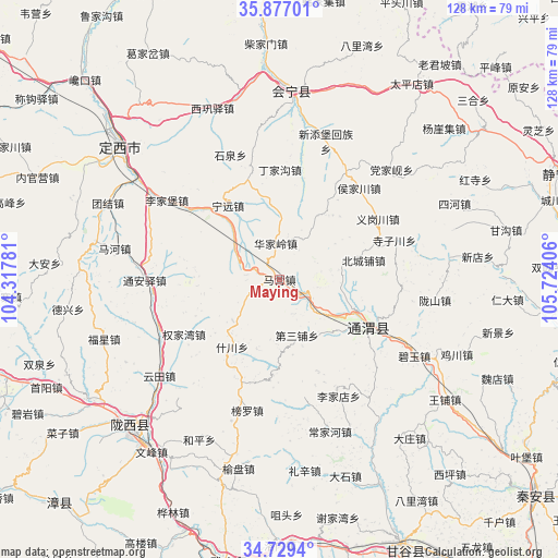
Maying GPS coordinates[2]
35° 18' 18.864" North, 105° 1' 15.348" East
| Map corner | latitude | longitude |
|---|---|---|
| Upper-left | 35.87701°, | 104.31781° |
| Center: | 35.30524°, | 105.02093° |
| Lower-right: | 34.7294°, | 105.72406° |
| Map W x H: | 127.6×127.6 km | = 79.3×79.3mi |
| max Lat: | 53.31946° ⇑24.4% North |
| Maying: | 35.30524° |
| min Lat: | ⇓75.6% South 18.22056° |
| min Long | Maying | max Long |
| 75.07348° | 105.02093° | 134.28917° |
| W 11%⇐ | ⇒89% E |
Elevation
Elevation of Maying is 2128 m = 6982 ft, and this is 1643.2 m = 5391 ft above average elevation for this country.
| Max E: |
5622 m = 18445 ft | 5% |
| Maying | 2128 m 6982 ft | |
| Avg. | 484.8 m = 1591 ft | |
Min E: |
-3 m = -10 ft | 95% |
See also: China elevation on elevation.city.
Geographical zone
Maying is located in North temperate zone (between Tropic of Cancer and the Arctic Circle). Distance of this Northern Tropic circle is 1319.7 km =820 mi to South.| Distance of | km | miles | from Maying |
|---|---|---|---|
| North Pole | 6081.5 | 3778.9 | to North |
| Arctic Circle | 3475.6 | 2159.6 | to North |
| Tropic Cancer | 1319.7 | 820 | to South |
| Equator | 3925.6 | 2439.3 | to South |


Nearby cities:
15 places around Maying: (largest is in red/bold)
• Dangjiaxian
35.7 km =22.2 mi,  45°
45°
• Dingxi
46.6 km =29 mi,  309°
309°
• Gongchang Zhen
48.6 km =30.2 mi,  225°
225°
• Houjiachuan
27.6 km =17.1 mi,  40°
40°
• Huajialing
8.3 km =5.2 mi,  352°
352°
• Huishi
43.1 km =26.8 mi,  3°
3°
• Jichuan
43.9 km =27.3 mi,  113°
113°
• Pingxiang
23.5 km =14.6 mi,  117°
117°
• Qingjiangyi
56.1 km =34.9 mi, 42°
• Santai Zhen
47.8 km =29.7 mi,  214°
214°
• Wangpu
46.7 km =29 mi,  126°
126°
• Wenfeng Zhen
49.1 km =30.5 mi,  216°
216°
• Xindian
45.4 km =28.2 mi,  83°
83°
• Zhongchuan
22 km =13.7 mi,  13°
13°
• Zhonghualu
50.9 km =31.6 mi, 310°
Sources, notices
• [Note1] Compared only with cities in China existing in our database
• [Src1] Map data: © OpenStreetMap contributors (CC-BY-SA)
• [Src2] Other city data from geonames.org with taken over terms of usage.
• [Src3] Geographical zone / Annual Mean Temperature by Robert A. Rohde @ Wikipedia
