Huajialing geodata
Huajialing (Gansu) is a seat of a fourth-order administrative division; located in China in Asia/Shanghai (GMT+8) time zone. In our database, there are 1268 cities with bigger population. Compared to other cities in China, 75.7% of cities are located further ↓South; 89.1% of cities are located further →East and 95.7% of cities have lower elevation than Huajialing. Note1


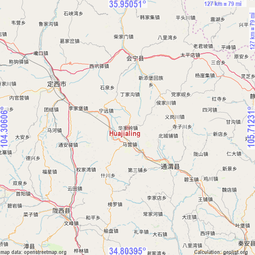
Huajialing GPS coordinates[2]
35° 22' 45.372" North, 105° 0' 33.048" East
| Map corner | latitude | longitude |
|---|---|---|
| Upper-left | 35.95051°, | 104.30606° |
| Center: | 35.37927°, | 105.00918° |
| Lower-right: | 34.80395°, | 105.71231° |
| Map W x H: | 127.5×127.5 km | = 79.2×79.2mi |
| max Lat: | 53.31946° ⇑24.3% North |
| Huajialing: | 35.37927° |
| min Lat: | ⇓75.7% South 18.22056° |
| min Long | Huajialing | max Long |
| 75.07348° | 105.00918° | 134.28917° |
| W 10.9%⇐ | ⇒89.1% E |
Elevation
Elevation of Huajialing is 2388 m = 7835 ft, and this is 1903.2 m = 6244 ft above average elevation for this country.
| Max E: |
5622 m = 18445 ft | 4.3% |
| Huajialing | 2388 m 7835 ft | |
| Avg. | 484.8 m = 1591 ft | |
Min E: |
-3 m = -10 ft | 95.7% |
See also: China elevation on elevation.city.
Geographical zone
Huajialing is located in North temperate zone (between Tropic of Cancer and the Arctic Circle). Distance of this Northern Tropic circle is 1327.9 km =825.1 mi to South.| Distance of | km | miles | from Huajialing |
|---|---|---|---|
| North Pole | 6073.3 | 3773.8 | to North |
| Arctic Circle | 3467.4 | 2154.5 | to North |
| Tropic Cancer | 1327.9 | 825.1 | to South |
| Equator | 3933.8 | 2444.3 | to South |


Nearby cities:
15 places around Huajialing: (largest is in red/bold)
• Dangjiaxian
31.3 km =19.4 mi,  57°
57°
• Dingxi
40.9 km =25.4 mi,  301°
301°
• Gongchang Zhen
54 km =33.6 mi,  218°
218°
• Houjiachuan
22.9 km =14.2 mi, 56°
• Huishi
35 km =21.7 mi,  5°
5°
• Jichuan
48.6 km =30.2 mi,  121°
121°
• Jieshipu
54.3 km =33.7 mi, 61°
• Maying
8.3 km =5.2 mi,  172°
172°
• Pingxiang
29 km =18 mi,  131°
131°
• Qingjiangyi
51.1 km =31.8 mi,  49°
49°
• Santai Zhen
54.3 km =33.7 mi,  208°
208°
• Wangpu
52.8 km =32.8 mi, 132°
• Xindian
46.2 km =28.7 mi,  93°
93°
• Zhongchuan
14.6 km =9.1 mi,  25°
25°
• Zhonghualu
45 km =28 mi, 303°
Sources, notices
• [Note1] Compared only with cities in China existing in our database
• [Src1] Map data: © OpenStreetMap contributors (CC-BY-SA)
• [Src2] Other city data from geonames.org with taken over terms of usage.
• [Src3] Geographical zone / Annual Mean Temperature by Robert A. Rohde @ Wikipedia
