Nagqu geodata
Nagqu (Tibet) is a seat of a third-order administrative division; located in China in Asia/Shanghai (GMT+8) time zone. In our database, there are 1268 cities with bigger population. Compared to other cities in China, 57.8% of cities are located further ↓South; 96.8% of cities are located further →East and 99.6% of cities have lower elevation than Nagqu. Note1


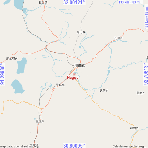
Nagqu GPS coordinates[2]
31° 24' 10.8" North, 92° 0' 10.8" East
| Map corner | latitude | longitude |
|---|---|---|
| Upper-left | 32.00121°, | 91.29988° |
| Center: | 31.403°, | 92.003° |
| Lower-right: | 30.80095°, | 92.70613° |
| Map W x H: | 133.5×133.5 km | = 83×83mi |
| max Lat: | 53.31946° ⇑42.2% North |
| Nagqu: | 31.403° |
| min Lat: | ⇓57.8% South 18.22056° |
| min Long | Nagqu | max Long |
| 75.07348° | 92.003° | 134.28917° |
| W 3.2%⇐ | ⇒96.8% E |
Elevation
Elevation of Nagqu is 4536 m = 14882 ft, and this is 4051.2 m = 13291 ft above average elevation for this country.
| Max E: |
5622 m = 18445 ft | 0.40000000000001% |
| Nagqu | 4536 m 14882 ft | |
| Avg. | 484.8 m = 1591 ft | |
Min E: |
-3 m = -10 ft | 99.6% |
See also: China elevation on elevation.city.
Geographical zone
Nagqu is located in North temperate zone (between Tropic of Cancer and the Arctic Circle). Distance of this Northern Tropic circle is 885.8 km =550.4 mi to South.| Distance of | km | miles | from Nagqu |
|---|---|---|---|
| North Pole | 6515.4 | 4048.5 | to North |
| Arctic Circle | 3909.5 | 2429.2 | to North |
| Tropic Cancer | 885.8 | 550.4 | to South |
| Equator | 3491.7 | 2169.6 | to South |


Nearby cities:
15 places around Nagqu: (largest is in red/bold)
• Dagsar
30.7 km =19.1 mi,  118°
118°
• Daqian
80.6 km =50.1 mi,  61°
61°
• Golug
73.4 km =45.6 mi,  209°
209°
• Kormang
51.8 km =32.2 mi,  50°
50°
• Lingti
73.6 km =45.7 mi,  132°
132°
• Lomai
62.3 km =38.7 mi,  105°
105°
• Nagqu
9.7 km =6 mi,  32°
32°
• Namaqie
57.4 km =35.7 mi,  284°
284°
• Nierong
83.7 km =52 mi,  19°
19°
• Nyima
46.2 km =28.7 mi, 30°
• Nyima
70.9 km =44.1 mi,  77°
77°
• Sexiong
78.9 km =49 mi,  90°
90°
• Xomong
52.6 km =32.7 mi,  216°
216°
• Zangbi
88.9 km =55.2 mi,  157°
157°
• Zaring
70.5 km =43.8 mi,  336°
336°
Sources, notices
• [Note1] Compared only with cities in China existing in our database
• [Src1] Map data: © OpenStreetMap contributors (CC-BY-SA)
• [Src2] Other city data from geonames.org with taken over terms of usage.
• [Src3] Geographical zone / Annual Mean Temperature by Robert A. Rohde @ Wikipedia
