Nierumai geodata
Nierumai (Tibet) is a seat of a fourth-order administrative division; located in China in Asia/Shanghai (GMT+8) time zone. In our database, there are 1268 cities with bigger population. Compared to other cities in China, 67.8% of cities are located further ↑North; 97.2% of cities are located further →East and 99.4% of cities have lower elevation than Nierumai. Note1


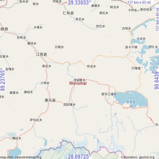
Nierumai GPS coordinates[2]
28° 42' 56.556" North, 89° 56' 26.772" East
| Map corner | latitude | longitude |
|---|---|---|
| Upper-left | 29.33053°, | 89.23765° |
| Center: | 28.71571°, | 89.94077° |
| Lower-right: | 28.09725°, | 90.6439° |
| Map W x H: | 137.1×137.1 km | = 85.2×85.2mi |
| max Lat: | 53.31946° ⇑67.8% North |
| Nierumai: | 28.71571° |
| min Lat: | ⇓32.2% South 18.22056° |
| min Long | Nierumai | max Long |
| 75.07348° | 89.94077° | 134.28917° |
| W 2.8%⇐ | ⇒97.2% E |
Elevation
Elevation of Nierumai is 4393 m = 14413 ft, and this is 3908.2 m = 12822 ft above average elevation for this country.
| Max E: |
5622 m = 18445 ft | 0.59999999999999% |
| Nierumai | 4393 m 14413 ft | |
| Avg. | 484.8 m = 1591 ft | |
Min E: |
-3 m = -10 ft | 99.4% |
See also: China elevation on elevation.city.
Geographical zone
Nierumai is located in North temperate zone (between Tropic of Cancer and the Arctic Circle). Distance of this Northern Tropic circle is 587 km =364.7 mi to South.| Distance of | km | miles | from Nierumai |
|---|---|---|---|
| North Pole | 6814.2 | 4234.1 | to North |
| Arctic Circle | 4208.3 | 2614.9 | to North |
| Tropic Cancer | 587 | 364.7 | to South |
| Equator | 3192.9 | 1984 | to South |


Nearby cities:
15 places around Nierumai: (largest is in red/bold)
• Cheren
28.8 km =17.9 mi,  304°
304°
• Jangra
41.4 km =25.7 mi, 300°
• Jiangzi
40.3 km =25 mi, 304°
• Kamru
45.4 km =28.2 mi,  256°
256°
• Kangmar
30.8 km =19.1 mi,  235°
235°
• Kangzhuo
47.4 km =29.5 mi,  293°
293°
• Lungmar
15.8 km =9.8 mi,  359°
359°
• Nanni
30.7 km =19.1 mi, 293°
• Niandui
33.4 km =20.8 mi,  305°
305°
• Nieru
22.9 km =14.2 mi,  202°
202°
• Pumaqangtang
28.2 km =17.5 mi,  115°
115°
• Ralung
15.7 km =9.8 mi,  40°
40°
• Ramba
49.7 km =30.9 mi,  21°
21°
• Samada
51.2 km =31.8 mi,  227°
227°
• Zijin
45.7 km =28.4 mi, 299°
Sources, notices
• [Note1] Compared only with cities in China existing in our database
• [Src1] Map data: © OpenStreetMap contributors (CC-BY-SA)
• [Src2] Other city data from geonames.org with taken over terms of usage.
• [Src3] Geographical zone / Annual Mean Temperature by Robert A. Rohde @ Wikipedia
