Lungmar geodata
Lungmar (Tibet) is a seat of a fourth-order administrative division; located in China in Asia/Shanghai (GMT+8) time zone. In our database, there are 1268 cities with bigger population. Compared to other cities in China, 66.7% of cities are located further ↑North; 97.2% of cities are located further →East and 99.3% of cities have lower elevation than Lungmar. Note1


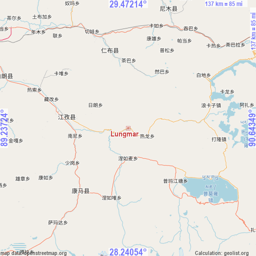
Lungmar GPS coordinates[2]
28° 51' 29.376" North, 89° 56' 25.296" East
| Map corner | latitude | longitude |
|---|---|---|
| Upper-left | 29.47214°, | 89.23724° |
| Center: | 28.85816°, | 89.94036° |
| Lower-right: | 28.24054°, | 90.64349° |
| Map W x H: | 136.9×136.9 km | = 85.1×85.1mi |
| max Lat: | 53.31946° ⇑66.7% North |
| Lungmar: | 28.85816° |
| min Lat: | ⇓33.3% South 18.22056° |
| min Long | Lungmar | max Long |
| 75.07348° | 89.94036° | 134.28917° |
| W 2.8%⇐ | ⇒97.2% E |
Elevation
Elevation of Lungmar is 4338 m = 14232 ft, and this is 3853.2 m = 12642 ft above average elevation for this country.
| Max E: |
5622 m = 18445 ft | 0.7% |
| Lungmar | 4338 m 14232 ft | |
| Avg. | 484.8 m = 1591 ft | |
Min E: |
-3 m = -10 ft | 99.3% |
See also: China elevation on elevation.city.
Geographical zone
Lungmar is located in North temperate zone (between Tropic of Cancer and the Arctic Circle). Distance of this Northern Tropic circle is 602.8 km =374.6 mi to South.| Distance of | km | miles | from Lungmar |
|---|---|---|---|
| North Pole | 6798.3 | 4224.3 | to North |
| Arctic Circle | 4192.4 | 2605 | to North |
| Tropic Cancer | 602.8 | 374.6 | to South |
| Equator | 3208.7 | 1993.8 | to South |


Nearby cities:
15 places around Lungmar: (largest is in red/bold)
• Chaba
36.4 km =22.6 mi,  0°
0°
• Cheren
23.7 km =14.7 mi,  271°
271°
• Dejilin
38.2 km =23.7 mi,  349°
349°
• Jangra
36.1 km =22.4 mi,  277°
277°
• Jiangzi
33.9 km =21.1 mi, 281°
• Kangmar
41.8 km =26 mi,  217°
217°
• Kangzhuo
43.4 km =27 mi, 274°
• Nanni
28.4 km =17.6 mi,  262°
262°
• Niandui
27.5 km =17.1 mi, 277°
• Nieru
38.1 km =23.7 mi,  193°
193°
• Nierumai
15.8 km =9.8 mi,  179°
179°
• Pumaqangtang
37.9 km =23.5 mi,  137°
137°
• Ralung
11.1 km =6.9 mi,  111°
111°
• Ramba
35.5 km =22.1 mi,  30°
30°
• Zijin
40.2 km =25 mi, 279°
Sources, notices
• [Note1] Compared only with cities in China existing in our database
• [Src1] Map data: © OpenStreetMap contributors (CC-BY-SA)
• [Src2] Other city data from geonames.org with taken over terms of usage.
• [Src3] Geographical zone / Annual Mean Temperature by Robert A. Rohde @ Wikipedia
