Zhexiao geodata
Zhexiao (Qinghai) is a seat of a fourth-order administrative division; located in China in Asia/Shanghai (GMT+8) time zone. In our database, there are 1268 cities with bigger population. Compared to other cities in China, 64.1% of cities are located further ↓South; 95.9% of cities are located further →East and 98.6% of cities have lower elevation than Zhexiao. Note1


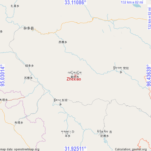
Zhexiao GPS coordinates[2]
32° 31' 11.784" North, 95° 43' 59.736" East
| Map corner | latitude | longitude |
|---|---|---|
| Upper-left | 33.11086°, | 95.03014° |
| Center: | 32.51994°, | 95.73326° |
| Lower-right: | 31.92511°, | 96.43639° |
| Map W x H: | 131.8×131.8 km | = 81.9×81.9mi |
| max Lat: | 53.31946° ⇑35.9% North |
| Zhexiao: | 32.51994° |
| min Lat: | ⇓64.1% South 18.22056° |
| min Long | Zhexiao | max Long |
| 75.07348° | 95.73326° | 134.28917° |
| W 4.1%⇐ | ⇒95.9% E |
Elevation
Elevation of Zhexiao is 3995 m = 13107 ft, and this is 3510.2 m = 11516 ft above average elevation for this country.
| Max E: |
5622 m = 18445 ft | 1.4% |
| Zhexiao | 3995 m 13107 ft | |
| Avg. | 484.8 m = 1591 ft | |
Min E: |
-3 m = -10 ft | 98.6% |
See also: China elevation on elevation.city.
Geographical zone
Zhexiao is located in North temperate zone (between Tropic of Cancer and the Arctic Circle). Distance of this Northern Tropic circle is 1010 km =627.6 mi to South.| Distance of | km | miles | from Zhexiao |
|---|---|---|---|
| North Pole | 6391.2 | 3971.3 | to North |
| Arctic Circle | 3785.3 | 2352.1 | to North |
| Tropic Cancer | 1010 | 627.6 | to South |
| Equator | 3615.9 | 2246.8 | to South |


Nearby cities:
15 places around Zhexiao: (largest is in red/bold)
• Aduo
79.2 km =49.2 mi,  306°
306°
• Domba
27.1 km =16.8 mi,  211°
211°
• Gaxung
50.9 km =31.6 mi,  188°
188°
• Gyairong
105.3 km =65.4 mi,  37°
37°
• Gyobrag
39.9 km =24.8 mi,  82°
82°
• Jieduo
41.2 km =25.6 mi,  282°
282°
• Jinisai
56.4 km =35 mi,  153°
153°
• Jiqu
72.9 km =45.3 mi, 150°
• Namsai
31.5 km =19.6 mi,  339°
339°
• Qiezha
88.5 km =55 mi,  123°
123°
• Shanglaxiu
87.9 km =54.6 mi,  64°
64°
• Sulu
42 km =26.1 mi,  266°
266°
• Xangda
78.2 km =48.6 mi, 116°
• Xialaxiu
83.8 km =52.1 mi, 78°
• Zaqing
80.6 km =50.1 mi,  319°
319°
Sources, notices
• [Note1] Compared only with cities in China existing in our database
• [Src1] Map data: © OpenStreetMap contributors (CC-BY-SA)
• [Src2] Other city data from geonames.org with taken over terms of usage.
• [Src3] Geographical zone / Annual Mean Temperature by Robert A. Rohde @ Wikipedia
