Qiezha geodata
Qiezha (Qinghai) is a seat of a fourth-order administrative division; located in China in Asia/Shanghai (GMT+8) time zone. In our database, there are 1268 cities with bigger population. Compared to other cities in China, 61.7% of cities are located further ↓South; 95.8% of cities are located further →East and 98.1% of cities have lower elevation than Qiezha. Note1


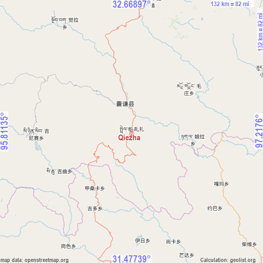
Qiezha GPS coordinates[2]
32° 4' 30.432" North, 96° 30' 52.092" East
| Map corner | latitude | longitude |
|---|---|---|
| Upper-left | 32.66897°, | 95.81135° |
| Center: | 32.07512°, | 96.51447° |
| Lower-right: | 31.47739°, | 97.2176° |
| Map W x H: | 132.5×132.5 km | = 82.3×82.3mi |
| max Lat: | 53.31946° ⇑38.3% North |
| Qiezha: | 32.07512° |
| min Lat: | ⇓61.7% South 18.22056° |
| min Long | Qiezha | max Long |
| 75.07348° | 96.51447° | 134.28917° |
| W 4.2%⇐ | ⇒95.8% E |
Elevation
Elevation of Qiezha is 3720 m = 12205 ft, and this is 3235.2 m = 10614 ft above average elevation for this country.
| Max E: |
5622 m = 18445 ft | 1.9% |
| Qiezha | 3720 m 12205 ft | |
| Avg. | 484.8 m = 1591 ft | |
Min E: |
-3 m = -10 ft | 98.1% |
See also: China elevation on elevation.city.
Geographical zone
Qiezha is located in North temperate zone (between Tropic of Cancer and the Arctic Circle). Distance of this Northern Tropic circle is 960.5 km =596.8 mi to South.| Distance of | km | miles | from Qiezha |
|---|---|---|---|
| North Pole | 6440.6 | 4002 | to North |
| Arctic Circle | 3834.8 | 2382.8 | to North |
| Tropic Cancer | 960.5 | 596.8 | to South |
| Equator | 3566.4 | 2216.1 | to South |


Nearby cities:
15 places around Qiezha: (largest is in red/bold)
• Baitang
102.7 km =63.8 mi,  35°
35°
• Domba
91.3 km =56.7 mi,  286°
286°
• Gaxung
80.8 km =50.2 mi,  269°
269°
• Gyobrag
64.3 km =40 mi,  328°
328°
• Jinisai
48.2 km =30 mi, 268°
• Jiqu
40 km =24.9 mi,  249°
249°
• Mozhong
36 km =22.4 mi,  53°
53°
• Nyagla
31 km =19.3 mi,  96°
96°
• Racaka
75.1 km =46.7 mi,  179°
179°
• Samdo
96.1 km =59.7 mi, 175°
• Shanglaxiu
86.8 km =53.9 mi,  4°
4°
• Xangda
14.9 km =9.3 mi,  346°
346°
• Xialaxiu
66.4 km =41.3 mi,  7°
7°
• Xiao Surmang
74.2 km =46.1 mi,  65°
65°
• Zhexiao
88.5 km =55 mi,  303°
303°
Sources, notices
• [Note1] Compared only with cities in China existing in our database
• [Src1] Map data: © OpenStreetMap contributors (CC-BY-SA)
• [Src2] Other city data from geonames.org with taken over terms of usage.
• [Src3] Geographical zone / Annual Mean Temperature by Robert A. Rohde @ Wikipedia
