Xangda geodata
Xangda (Qinghai) is a seat of a third-order administrative division; located in China in Asia/Shanghai (GMT+8) time zone. In our database, there are 1268 cities with bigger population. Compared to other cities in China, 62.5% of cities are located further ↓South; 95.8% of cities are located further →East and 98% of cities have lower elevation than Xangda. Note1


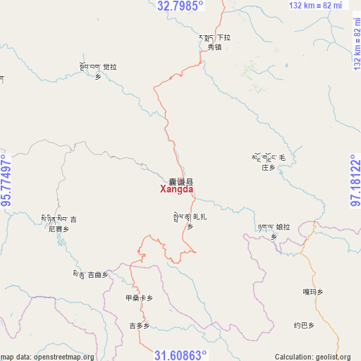
Xangda GPS coordinates[2]
32° 12' 19.836" North, 96° 28' 41.124" East
| Map corner | latitude | longitude |
|---|---|---|
| Upper-left | 32.7985°, | 95.77497° |
| Center: | 32.20551°, | 96.47809° |
| Lower-right: | 31.60863°, | 97.18122° |
| Map W x H: | 132.3×132.3 km | = 82.2×82.2mi |
| max Lat: | 53.31946° ⇑37.5% North |
| Xangda: | 32.20551° |
| min Lat: | ⇓62.5% South 18.22056° |
| min Long | Xangda | max Long |
| 75.07348° | 96.47809° | 134.28917° |
| W 4.2%⇐ | ⇒95.8% E |
Elevation
Elevation of Xangda is 3655 m = 11991 ft, and this is 3170.2 m = 10401 ft above average elevation for this country.
| Max E: |
5622 m = 18445 ft | 2% |
| Xangda | 3655 m 11991 ft | |
| Avg. | 484.8 m = 1591 ft | |
Min E: |
-3 m = -10 ft | 98% |
See also: China elevation on elevation.city.
Geographical zone
Xangda is located in North temperate zone (between Tropic of Cancer and the Arctic Circle). Distance of this Northern Tropic circle is 975 km =605.8 mi to South.| Distance of | km | miles | from Xangda |
|---|---|---|---|
| North Pole | 6426.1 | 3993 | to North |
| Arctic Circle | 3820.3 | 2373.8 | to North |
| Tropic Cancer | 975 | 605.8 | to South |
| Equator | 3580.9 | 2225.1 | to South |


Nearby cities:
15 places around Xangda: (largest is in red/bold)
• Baitang
93.6 km =58.2 mi,  42°
42°
• Domba
84.8 km =52.7 mi,  277°
277°
• Gaxung
78.8 km =49 mi,  258°
258°
• Gyobrag
50.4 km =31.3 mi,  322°
322°
• Jinisai
47.4 km =29.5 mi,  250°
250°
• Jiqu
44.3 km =27.5 mi,  230°
230°
• Mozhong
33 km =20.5 mi,  77°
77°
• Namsai
103.5 km =64.3 mi,  308°
308°
• Nyagla
38.7 km =24 mi,  118°
118°
• Qiezha
14.9 km =9.3 mi,  166°
166°
• Racaka
89.6 km =55.7 mi,  177°
177°
• Shanglaxiu
72.8 km =45.2 mi,  7°
7°
• Xialaxiu
52.8 km =32.8 mi, 13°
• Xiao Surmang
72.8 km =45.2 mi, 77°
• Zhexiao
78.2 km =48.6 mi,  296°
296°
Sources, notices
• [Note1] Compared only with cities in China existing in our database
• [Src1] Map data: © OpenStreetMap contributors (CC-BY-SA)
• [Src2] Other city data from geonames.org with taken over terms of usage.
• [Src3] Geographical zone / Annual Mean Temperature by Robert A. Rohde @ Wikipedia
