Gaxung geodata
Gaxung (Qinghai) is a seat of a fourth-order administrative division; located in China in Asia/Shanghai (GMT+8) time zone. In our database, there are 1268 cities with bigger population. Compared to other cities in China, 61.6% of cities are located further ↓South; 95.9% of cities are located further →East and 99.1% of cities have lower elevation than Gaxung. Note1


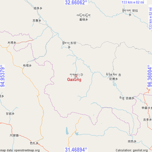
Gaxung GPS coordinates[2]
32° 4' 0.192" North, 95° 39' 24.876" East
| Map corner | latitude | longitude |
|---|---|---|
| Upper-left | 32.66062°, | 94.95379° |
| Center: | 32.06672°, | 95.65691° |
| Lower-right: | 31.46894°, | 96.36004° |
| Map W x H: | 132.5×132.5 km | = 82.3×82.3mi |
| max Lat: | 53.31946° ⇑38.4% North |
| Gaxung: | 32.06672° |
| min Lat: | ⇓61.6% South 18.22056° |
| min Long | Gaxung | max Long |
| 75.07348° | 95.65691° | 134.28917° |
| W 4.1%⇐ | ⇒95.9% E |
Elevation
Elevation of Gaxung is 4213 m = 13822 ft, and this is 3728.2 m = 12232 ft above average elevation for this country.
| Max E: |
5622 m = 18445 ft | 0.90000000000001% |
| Gaxung | 4213 m 13822 ft | |
| Avg. | 484.8 m = 1591 ft | |
Min E: |
-3 m = -10 ft | 99.1% |
See also: China elevation on elevation.city.
Geographical zone
Gaxung is located in North temperate zone (between Tropic of Cancer and the Arctic Circle). Distance of this Northern Tropic circle is 959.6 km =596.3 mi to South.| Distance of | km | miles | from Gaxung |
|---|---|---|---|
| North Pole | 6441.6 | 4002.6 | to North |
| Arctic Circle | 3835.7 | 2383.4 | to North |
| Tropic Cancer | 959.6 | 596.3 | to South |
| Equator | 3565.5 | 2215.5 | to South |


Nearby cities:
15 places around Gaxung: (largest is in red/bold)
• Dingqing
73.2 km =45.5 mi,  185°
185°
• Domba
28 km =17.4 mi,  345°
345°
• Gyamotang
63 km =39.1 mi,  199°
199°
• Gyobrag
72.7 km =45.2 mi,  40°
40°
• Jieduo
68 km =42.3 mi,  330°
330°
• Jinisai
32.6 km =20.3 mi,  90°
90°
• Jiqu
45.2 km =28.1 mi,  106°
106°
• Namsai
80 km =49.7 mi,  357°
357°
• Nyagla
111.6 km =69.3 mi, 91°
• Qiezha
80.8 km =50.2 mi, 89°
• Racaka
110 km =68.4 mi,  132°
132°
• Sulu
59.4 km =36.9 mi,  324°
324°
• Xangda
78.8 km =49 mi,  78°
78°
• Xiexiong
73.1 km =45.4 mi,  182°
182°
• Zhexiao
50.9 km =31.6 mi,  8°
8°
Sources, notices
• [Note1] Compared only with cities in China existing in our database
• [Src1] Map data: © OpenStreetMap contributors (CC-BY-SA)
• [Src2] Other city data from geonames.org with taken over terms of usage.
• [Src3] Geographical zone / Annual Mean Temperature by Robert A. Rohde @ Wikipedia
