Gongrong geodata
Gongrong (Heilongjiang) is a seat of a fourth-order administrative division; located in China in Asia/Shanghai (GMT+8) time zone. In our database, there are 1268 cities with bigger population. Compared to other cities in China, 97.2% of cities are located further ↓South; 96.4% of cities are located further ←West and 56.6% of cities have lower elevation than Gongrong. Note1


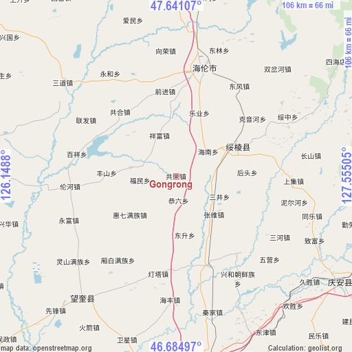
Gongrong GPS coordinates[2]
47° 9' 54.612" North, 126° 51' 6.912" East
| Map corner | latitude | longitude |
|---|---|---|
| Upper-left | 47.64107°, | 126.1488° |
| Center: | 47.16517°, | 126.85192° |
| Lower-right: | 46.68497°, | 127.55505° |
| Map W x H: | 106.3×106.3 km | = 66.1×66.1mi |
| max Lat: | 53.31946° ⇑2.8% North |
| Gongrong: | 47.16517° |
| min Lat: | ⇓97.2% South 18.22056° |
| min Long | Gongrong | max Long |
| 75.07348° | 126.85192° | 134.28917° |
| W 96.4%⇐ | ⇒3.6% E |
Elevation
Elevation of Gongrong is 222 m = 728 ft, and this is 262.8 m = 862 ft below average elevation for this country.
| Max E: |
5622 m = 18445 ft | 43.4% |
| Avg. | 484.8 m = 1591 ft | |
| Gongrong | 222 m = 728 ft | |
Min E: |
-3 m = -10 ft | 56.6% |
See also: China elevation on elevation.city.
Geographical zone
Gongrong is located in North temperate zone (between Tropic of Cancer and the Arctic Circle). Distance of this North polar circle is 2156.9 km =1340.2 mi to North.| Distance of | km | miles | from Gongrong |
|---|---|---|---|
| North Pole | 4762.8 | 2959.5 | to North |
| Arctic Circle | 2156.9 | 1340.2 | to North |
| Tropic Cancer | 2638.4 | 1639.4 | to South |
| Equator | 5244.3 | 3258.7 | to South |


Nearby cities:
15 places around Gongrong: (largest is in red/bold)
• Dongsheng
18.1 km =11.2 mi,  172°
172°
• Fengshan
20.8 km =12.9 mi,  272°
272°
• Fumin
10.6 km =6.6 mi,  263°
263°
• Gongliu
7.3 km =4.5 mi, 173°
• Hainan
12.3 km =7.6 mi,  52°
52°
• Haixing
14 km =8.7 mi,  280°
280°
• Houtou
21.7 km =13.5 mi,  87°
87°
• Huiqi
18.1 km =11.2 mi,  229°
229°
• Kaoshan
22.6 km =14 mi,  73°
73°
• Leye
15.8 km =9.8 mi,  26°
26°
• Lianhua
19.7 km =12.2 mi,  189°
189°
• Sanjing
14.5 km =9 mi,  115°
115°
• Suileng
20.6 km =12.8 mi,  63°
63°
• Xiangfu
13.4 km =8.3 mi,  336°
336°
• Zhangxiong
16.3 km =10.1 mi,  135°
135°
Sources, notices
• [Note1] Compared only with cities in China existing in our database
• [Src1] Map data: © OpenStreetMap contributors (CC-BY-SA)
• [Src2] Other city data from geonames.org with taken over terms of usage.
• [Src3] Geographical zone / Annual Mean Temperature by Robert A. Rohde @ Wikipedia
