Shuangjing geodata
Shuangjing (Heilongjiang) is a seat of a fourth-order administrative division; located in China in Asia/Shanghai (GMT+8) time zone. In our database, there are 1268 cities with bigger population. Compared to other cities in China, 95% of cities are located further ↓South; 96.3% of cities are located further ←West and 55.4% of cities have higher elevation than Shuangjing. Note1


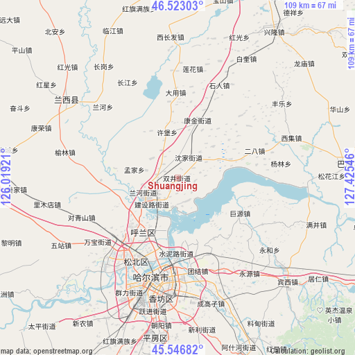
Shuangjing GPS coordinates[2]
46° 2' 13.488" North, 126° 43' 20.388" East
| Map corner | latitude | longitude |
|---|---|---|
| Upper-left | 46.52303°, | 126.01921° |
| Center: | 46.03708°, | 126.72233° |
| Lower-right: | 45.54682°, | 127.42546° |
| Map W x H: | 108.5×108.5 km | = 67.4×67.4mi |
| max Lat: | 53.31946° ⇑5% North |
| Shuangjing: | 46.03708° |
| min Lat: | ⇓95% South 18.22056° |
| min Long | Shuangjing | max Long |
| 75.07348° | 126.72233° | 134.28917° |
| W 96.3%⇐ | ⇒3.7% E |
Elevation
Elevation of Shuangjing is 129 m = 423 ft, and this is 355.8 m = 1167 ft below average elevation for this country.
| Max E: |
5622 m = 18445 ft | 55.4% |
| Avg. | 484.8 m = 1591 ft | |
| Shuangjing | 129 m = 423 ft | |
Min E: |
-3 m = -10 ft | 44.6% |
See also: China elevation on elevation.city.
Geographical zone
Shuangjing is located in North temperate zone (between Tropic of Cancer and the Arctic Circle). Distance of this North polar circle is 2282.3 km =1418.2 mi to North.| Distance of | km | miles | from Shuangjing |
|---|---|---|---|
| North Pole | 4888.2 | 3037.4 | to North |
| Arctic Circle | 2282.3 | 1418.2 | to North |
| Tropic Cancer | 2512.9 | 1561.4 | to South |
| Equator | 5118.8 | 3180.7 | to South |


Nearby cities:
15 places around Shuangjing: (largest is in red/bold)
• Changling
6.4 km =4 mi,  279°
279°
• Dayong
27.5 km =17.1 mi,  358°
358°
• Erba
25.1 km =15.6 mi,  70°
70°
• Fangtai
17.3 km =10.7 mi, 70°
• Harbin
32.4 km =20.1 mi,  189°
189°
• Hulan
11.2 km =7 mi,  237°
237°
• Juyuan
22 km =13.7 mi,  118°
118°
• Kangjin
18.9 km =11.7 mi,  19°
19°
• Lanhe
29.1 km =18.1 mi,  312°
312°
• Mengjia
13.4 km =8.3 mi, 280°
• Shenjia
7.1 km =4.4 mi,  29°
29°
• Shiren
31.2 km =19.4 mi, 24°
• Tangfang
29.5 km =18.3 mi, 118°
• Xubao
14.4 km =8.9 mi,  346°
346°
• Yanglin
31.9 km =19.8 mi,  81°
81°
Sources, notices
• [Note1] Compared only with cities in China existing in our database
• [Src1] Map data: © OpenStreetMap contributors (CC-BY-SA)
• [Src2] Other city data from geonames.org with taken over terms of usage.
• [Src3] Geographical zone / Annual Mean Temperature by Robert A. Rohde @ Wikipedia
