Qingshan geodata
Qingshan (Heilongjiang) is a seat of a fourth-order administrative division; located in China in Asia/Shanghai (GMT+8) time zone. In our database, there are 1268 cities with bigger population. Compared to other cities in China, 99% of cities are located further ↓South; 99.1% of cities are located further ←West and 57.4% of cities have lower elevation than Qingshan. Note1


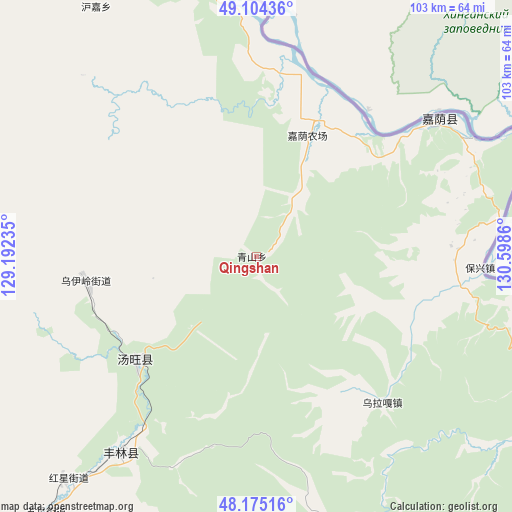
Qingshan GPS coordinates[2]
48° 38' 30.84" North, 129° 53' 43.692" East
| Map corner | latitude | longitude |
|---|---|---|
| Upper-left | 49.10436°, | 129.19235° |
| Center: | 48.6419°, | 129.89547° |
| Lower-right: | 48.17516°, | 130.5986° |
| Map W x H: | 103.3×103.3 km | = 64.2×64.2mi |
| max Lat: | 53.31946° ⇑1% North |
| Qingshan: | 48.6419° |
| min Lat: | ⇓99% South 18.22056° |
| min Long | Qingshan | max Long |
| 75.07348° | 129.89547° | 134.28917° |
| W 99.1%⇐ | ⇒0.90000000000001% E |
Elevation
Elevation of Qingshan is 229 m = 751 ft, and this is 255.8 m = 839 ft below average elevation for this country.
| Max E: |
5622 m = 18445 ft | 42.6% |
| Avg. | 484.8 m = 1591 ft | |
| Qingshan | 229 m = 751 ft | |
Min E: |
-3 m = -10 ft | 57.4% |
See also: China elevation on elevation.city.
Geographical zone
Qingshan is located in North temperate zone (between Tropic of Cancer and the Arctic Circle). Distance of this North polar circle is 1992.7 km =1238.2 mi to North.| Distance of | km | miles | from Qingshan |
|---|---|---|---|
| North Pole | 4598.6 | 2857.4 | to North |
| Arctic Circle | 1992.7 | 1238.2 | to North |
| Tropic Cancer | 2802.6 | 1741.5 | to South |
| Equator | 5408.5 | 3360.7 | to South |


Nearby cities:
15 places around Qingshan: (largest is in red/bold)
• Baoshan
86.3 km =53.6 mi,  305°
305°
• Baoxing
45.5 km =28.3 mi,  93°
93°
• Changsheng
89.6 km =55.7 mi,  341°
341°
• Chaoyang
46.1 km =28.6 mi,  53°
53°
• Hongguang
48.8 km =30.3 mi,  67°
67°
• Hongshan
98.3 km =61.1 mi,  221°
221°
• Huanshan
116.2 km =72.2 mi,  151°
151°
• Hujia
59.7 km =37.1 mi,  327°
327°
• Kelin
70.5 km =43.8 mi,  276°
276°
• Taipinggou
79.6 km =49.5 mi,  135°
135°
• Wulaga
32.2 km =20 mi, 146°
• Wuyun
73.2 km =45.5 mi,  345°
345°
• Xiangyang
60.8 km =37.8 mi, 350°
• Xinqing
48.1 km =29.9 mi,  214°
214°
• Xinxing
103.8 km =64.5 mi,  321°
321°
Sources, notices
• [Note1] Compared only with cities in China existing in our database
• [Src1] Map data: © OpenStreetMap contributors (CC-BY-SA)
• [Src2] Other city data from geonames.org with taken over terms of usage.
• [Src3] Geographical zone / Annual Mean Temperature by Robert A. Rohde @ Wikipedia
