Xiangyang geodata
Xiangyang (Heilongjiang) is a seat of a fourth-order administrative division; located in China in Asia/Shanghai (GMT+8) time zone. In our database, there are 1268 cities with bigger population. Compared to other cities in China, 99.2% of cities are located further ↓South; 99% of cities are located further ←West and 60.4% of cities have higher elevation than Xiangyang. Note1


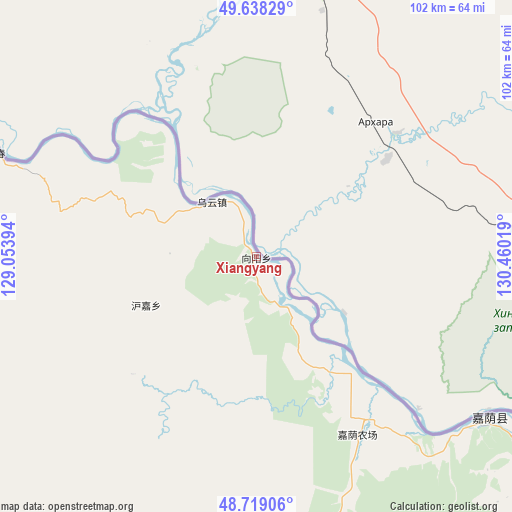
Xiangyang GPS coordinates[2]
49° 10' 50.916" North, 129° 45' 25.416" East
| Map corner | latitude | longitude |
|---|---|---|
| Upper-left | 49.63829°, | 129.05394° |
| Center: | 49.18081°, | 129.75706° |
| Lower-right: | 48.71906°, | 130.46019° |
| Map W x H: | 102.2×102.2 km | = 63.5×63.5mi |
| max Lat: | 53.31946° ⇑0.8% North |
| Xiangyang: | 49.18081° |
| min Lat: | ⇓99.2% South 18.22056° |
| min Long | Xiangyang | max Long |
| 75.07348° | 129.75706° | 134.28917° |
| W 99%⇐ | ⇒1% E |
Elevation
Elevation of Xiangyang is 96 m = 315 ft, and this is 388.8 m = 1276 ft below average elevation for this country.
| Max E: |
5622 m = 18445 ft | 60.4% |
| Avg. | 484.8 m = 1591 ft | |
| Xiangyang | 96 m = 315 ft | |
Min E: |
-3 m = -10 ft | 39.6% |
See also: China elevation on elevation.city.
Geographical zone
Xiangyang is located in North temperate zone (between Tropic of Cancer and the Arctic Circle). Distance of this North polar circle is 1932.8 km =1201 mi to North.| Distance of | km | miles | from Xiangyang |
|---|---|---|---|
| North Pole | 4538.7 | 2820.2 | to North |
| Arctic Circle | 1932.8 | 1201 | to North |
| Tropic Cancer | 2862.5 | 1778.7 | to South |
| Equator | 5468.4 | 3397.9 | to South |


Nearby cities:
15 places around Xiangyang: (largest is in red/bold)
• Baoshan
60.9 km =37.8 mi,  260°
260°
• Baoxing
83.6 km =51.9 mi,  138°
138°
• Bianjiang
102 km =63.4 mi,  294°
294°
• Changsheng
30.8 km =19.1 mi,  325°
325°
• Chaoyang
57.4 km =35.7 mi,  124°
124°
• Chelu
76.2 km =47.3 mi, 292°
• Hongguang
68.9 km =42.8 mi,  127°
127°
• Hujia
24.1 km =15 mi,  246°
246°
• Kelin
78.8 km =49 mi,  229°
229°
• Qingshan
60.8 km =37.8 mi,  170°
170°
• Songshugou
83.7 km =52 mi,  282°
282°
• Wulaga
91.2 km =56.7 mi,  162°
162°
• Wuyun
13.8 km =8.6 mi,  321°
321°
• Xinqing
100.8 km =62.6 mi,  189°
189°
• Xinxing
58.6 km =36.4 mi, 290°
Sources, notices
• [Note1] Compared only with cities in China existing in our database
• [Src1] Map data: © OpenStreetMap contributors (CC-BY-SA)
• [Src2] Other city data from geonames.org with taken over terms of usage.
• [Src3] Geographical zone / Annual Mean Temperature by Robert A. Rohde @ Wikipedia
