Wulaga geodata
Wulaga (Heilongjiang) is a seat of a fourth-order administrative division; located in China in Asia/Shanghai (GMT+8) time zone. In our database, there are 1268 cities with bigger population. Compared to other cities in China, 98.8% of cities are located further ↓South; 99.2% of cities are located further ←West and 51.9% of cities have lower elevation than Wulaga. Note1


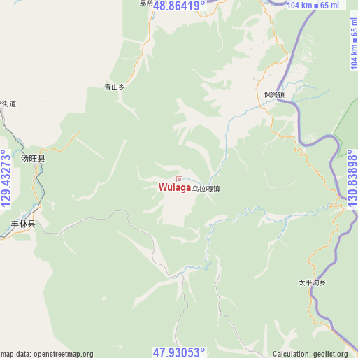
Wulaga GPS coordinates[2]
48° 23' 58.2" North, 130° 8' 9.06" East
| Map corner | latitude | longitude |
|---|---|---|
| Upper-left | 48.86419°, | 129.43273° |
| Center: | 48.3995°, | 130.13585° |
| Lower-right: | 47.93053°, | 130.83898° |
| Map W x H: | 103.8×103.8 km | = 64.5×64.5mi |
| max Lat: | 53.31946° ⇑1.2% North |
| Wulaga: | 48.3995° |
| min Lat: | ⇓98.8% South 18.22056° |
| min Long | Wulaga | max Long |
| 75.07348° | 130.13585° | 134.28917° |
| W 99.2%⇐ | ⇒0.8% E |
Elevation
Elevation of Wulaga is 180 m = 591 ft, and this is 304.8 m = 1000 ft below average elevation for this country.
| Max E: |
5622 m = 18445 ft | 48.1% |
| Avg. | 484.8 m = 1591 ft | |
| Wulaga | 180 m = 591 ft | |
Min E: |
-3 m = -10 ft | 51.9% |
See also: China elevation on elevation.city.
Geographical zone
Wulaga is located in North temperate zone (between Tropic of Cancer and the Arctic Circle). Distance of this North polar circle is 2019.7 km =1255 mi to North.| Distance of | km | miles | from Wulaga |
|---|---|---|---|
| North Pole | 4625.5 | 2874.2 | to North |
| Arctic Circle | 2019.7 | 1255 | to North |
| Tropic Cancer | 2775.6 | 1724.7 | to South |
| Equator | 5381.5 | 3343.9 | to South |


Nearby cities:
15 places around Wulaga: (largest is in red/bold)
• Baoxing
36.8 km =22.9 mi,  49°
49°
• Chaoyang
57.6 km =35.8 mi,  19°
19°
• Dongming
105.7 km =65.7 mi,  150°
150°
• Fengxiang
104.9 km =65.2 mi, 150°
• Hebei
97.1 km =60.3 mi,  166°
166°
• Hongguang
53.1 km =33 mi,  31°
31°
• Hongshan
95.1 km =59.1 mi,  240°
240°
• Huanshan
84.1 km =52.3 mi, 153°
• Hujia
92 km =57.2 mi,  327°
327°
• Kelin
94.6 km =58.8 mi,  291°
291°
• Qingshan
32.2 km =20 mi, 326°
• Taipinggou
48.3 km =30 mi,  128°
128°
• Wuyun
104.3 km =64.8 mi,  339°
339°
• Xiangyang
91.2 km =56.7 mi, 342°
• Xinqing
47 km =29.2 mi,  254°
254°
Sources, notices
• [Note1] Compared only with cities in China existing in our database
• [Src1] Map data: © OpenStreetMap contributors (CC-BY-SA)
• [Src2] Other city data from geonames.org with taken over terms of usage.
• [Src3] Geographical zone / Annual Mean Temperature by Robert A. Rohde @ Wikipedia
