Yuhuangding geodata
Yuhuangding (Hubei) is a seat of a fourth-order administrative division; located in China in Asia/Shanghai (GMT+8) time zone. In our database, there are 1268 cities with bigger population. Compared to other cities in China, 64.9% of cities are located further ↓South; 65.3% of cities are located further →East and 59.1% of cities have lower elevation than Yuhuangding. Note1


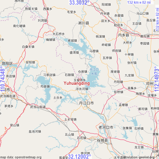
Yuhuangding GPS coordinates[2]
32° 42' 48.852" North, 111° 26' 47.76" East
| Map corner | latitude | longitude |
|---|---|---|
| Upper-left | 33.3032°, | 110.74348° |
| Center: | 32.71357°, | 111.4466° |
| Lower-right: | 32.12002°, | 112.14973° |
| Map W x H: | 131.6×131.6 km | = 81.8×81.8mi |
| max Lat: | 53.31946° ⇑35.1% North |
| Yuhuangding: | 32.71357° |
| min Lat: | ⇓64.9% South 18.22056° |
| min Long | Yuhuangding | max Long |
| 75.07348° | 111.4466° | 134.28917° |
| W 34.7%⇐ | ⇒65.3% E |
Elevation
Elevation of Yuhuangding is 248 m = 814 ft, and this is 236.8 m = 777 ft below average elevation for this country.
| Max E: |
5622 m = 18445 ft | 40.9% |
| Avg. | 484.8 m = 1591 ft | |
| Yuhuangding | 248 m = 814 ft | |
Min E: |
-3 m = -10 ft | 59.1% |
See also: China elevation on elevation.city.
Geographical zone
Yuhuangding is located in North temperate zone (between Tropic of Cancer and the Arctic Circle). Distance of this Northern Tropic circle is 1031.5 km =640.9 mi to South.| Distance of | km | miles | from Yuhuangding |
|---|---|---|---|
| North Pole | 6369.7 | 3957.9 | to North |
| Arctic Circle | 3763.8 | 2338.7 | to North |
| Tropic Cancer | 1031.5 | 640.9 | to South |
| Equator | 3637.4 | 2260.2 | to South |


Nearby cities:
15 places around Yuhuangding: (largest is in red/bold)
• Danjiangkou
19.9 km =12.4 mi,  162°
162°
• Danzhaolu
19.4 km =12.1 mi, 156°
• Haoping
17.9 km =11.1 mi,  281°
281°
• Hongshanzui
35.1 km =21.8 mi,  145°
145°
• Junxian
29.2 km =18.1 mi,  259°
259°
• Langhe
36.6 km =22.7 mi,  208°
208°
• Lengji
40.9 km =25.4 mi, 160°
• Liangshuihe
7.7 km =4.8 mi,  166°
166°
• Sanguandian
22.4 km =13.9 mi, 170°
• Shigu
9.5 km =5.9 mi,  297°
297°
• Tuguanya
33.5 km =20.8 mi,  193°
193°
• Tutai
22.4 km =13.9 mi,  231°
231°
• Wudangshan
41.1 km =25.5 mi,  237°
237°
• Xijiadian
25.4 km =15.8 mi, 279°
• Yuanchong
34 km =21.1 mi,  127°
127°
Sources, notices
• [Note1] Compared only with cities in China existing in our database
• [Src1] Map data: © OpenStreetMap contributors (CC-BY-SA)
• [Src2] Other city data from geonames.org with taken over terms of usage.
• [Src3] Geographical zone / Annual Mean Temperature by Robert A. Rohde @ Wikipedia
