Sanguandian geodata
Sanguandian (Hubei) is a seat of a fourth-order administrative division; located in China in Asia/Shanghai (GMT+8) time zone. In our database, there are 1268 cities with bigger population. Compared to other cities in China, 64% of cities are located further ↓South; 65.1% of cities are located further →East and 55.4% of cities have higher elevation than Sanguandian. Note1


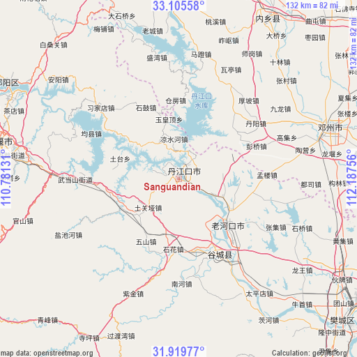
Sanguandian GPS coordinates[2]
32° 30' 52.668" North, 111° 29' 3.948" East
| Map corner | latitude | longitude |
|---|---|---|
| Upper-left | 33.10558°, | 110.78131° |
| Center: | 32.51463°, | 111.48443° |
| Lower-right: | 31.91977°, | 112.18756° |
| Map W x H: | 131.8×131.9 km | = 81.9×82mi |
| max Lat: | 53.31946° ⇑36% North |
| Sanguandian: | 32.51463° |
| min Lat: | ⇓64% South 18.22056° |
| min Long | Sanguandian | max Long |
| 75.07348° | 111.48443° | 134.28917° |
| W 34.9%⇐ | ⇒65.1% E |
Elevation
Elevation of Sanguandian is 129 m = 423 ft, and this is 355.8 m = 1167 ft below average elevation for this country.
| Max E: |
5622 m = 18445 ft | 55.4% |
| Avg. | 484.8 m = 1591 ft | |
| Sanguandian | 129 m = 423 ft | |
Min E: |
-3 m = -10 ft | 44.6% |
See also: China elevation on elevation.city.
Geographical zone
Sanguandian is located in North temperate zone (between Tropic of Cancer and the Arctic Circle). Distance of this Northern Tropic circle is 1009.4 km =627.2 mi to South.| Distance of | km | miles | from Sanguandian |
|---|---|---|---|
| North Pole | 6391.8 | 3971.7 | to North |
| Arctic Circle | 3785.9 | 2352.4 | to North |
| Tropic Cancer | 1009.4 | 627.2 | to South |
| Equator | 3615.3 | 2246.4 | to South |


Nearby cities:
15 places around Sanguandian: (largest is in red/bold)
• Danjiangkou
3.9 km =2.4 mi,  35°
35°
• Danzhaolu
5.9 km =3.7 mi, 43°
• Gucheng Chengguanzhen
31 km =19.3 mi,  152°
152°
• Hongshanzui
17.8 km =11.1 mi,  112°
112°
• Langhe
23.3 km =14.5 mi,  244°
244°
• Laohekou
22.4 km =13.9 mi,  129°
129°
• Lengji
19.3 km =12 mi, 148°
• Liangshuihe
14.7 km =9.1 mi,  353°
353°
• Shigu
29.1 km =18.1 mi,  335°
335°
• Shihua
26.4 km =16.4 mi,  185°
185°
• Tuguanya
15.4 km =9.6 mi,  227°
227°
• Tutai
22.5 km =14 mi,  291°
291°
• Wushan
25.9 km =16.1 mi,  207°
207°
• Yuanchong
23.4 km =14.5 mi,  86°
86°
• Yuhuangding
22.4 km =13.9 mi, 350°
Sources, notices
• [Note1] Compared only with cities in China existing in our database
• [Src1] Map data: © OpenStreetMap contributors (CC-BY-SA)
• [Src2] Other city data from geonames.org with taken over terms of usage.
• [Src3] Geographical zone / Annual Mean Temperature by Robert A. Rohde @ Wikipedia
