Kalabulegen geodata
Kalabulegen (Heilongjiang) is a seat of a fourth-order administrative division; located in China in Asia/Urumqi (GMT+6) time zone. In our database, there are 1268 cities with bigger population. Compared to other cities in China, 95.7% of cities are located further ↓South; 97.8% of cities are located further →East and 79.9% of cities have lower elevation than Kalabulegen. Note1


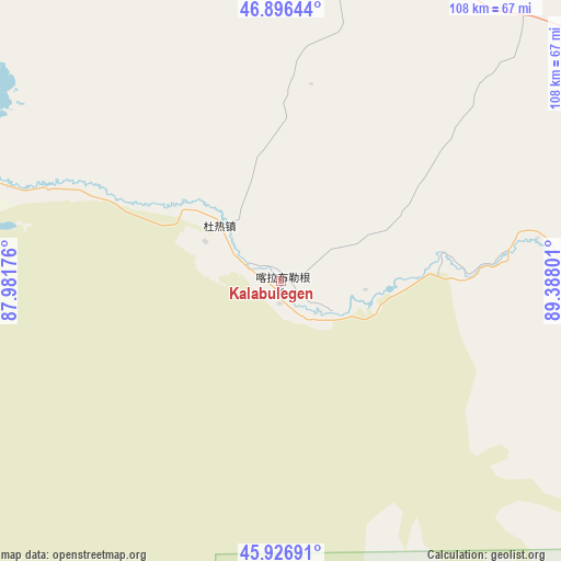
Kalabulegen GPS coordinates[2]
46° 24' 49.788" North, 88° 41' 5.568" East
| Map corner | latitude | longitude |
|---|---|---|
| Upper-left | 46.89644°, | 87.98176° |
| Center: | 46.41383°, | 88.68488° |
| Lower-right: | 45.92691°, | 89.38801° |
| Map W x H: | 107.8×107.8 km | = 67×67mi |
| max Lat: | 53.31946° ⇑4.3% North |
| Kalabulegen: | 46.41383° |
| min Lat: | ⇓95.7% South 18.22056° |
| min Long | Kalabulegen | max Long |
| 75.07348° | 88.68488° | 134.28917° |
| W 2.2%⇐ | ⇒97.8% E |
Elevation
Elevation of Kalabulegen is 694 m = 2277 ft, and this is 209.2 m = 686 ft above average elevation for this country.
| Max E: |
5622 m = 18445 ft | 20.1% |
| Kalabulegen | 694 m 2277 ft | |
| Avg. | 484.8 m = 1591 ft | |
Min E: |
-3 m = -10 ft | 79.9% |
See also: China elevation on elevation.city.
Geographical zone
Kalabulegen is located in North temperate zone (between Tropic of Cancer and the Arctic Circle). Distance of this North polar circle is 2240.4 km =1392.1 mi to North.| Distance of | km | miles | from Kalabulegen |
|---|---|---|---|
| North Pole | 4846.3 | 3011.4 | to North |
| Arctic Circle | 2240.4 | 1392.1 | to North |
| Tropic Cancer | 2554.8 | 1587.5 | to South |
| Equator | 5160.7 | 3206.7 | to South |


Nearby cities:
15 places around Kalabulegen: (largest is in red/bold)
• Araltobe
117.9 km =73.3 mi,  84°
84°
• A’erda
120.1 km =74.6 mi,  311°
311°
• Dure
17.1 km =10.6 mi,  256°
256°
• Ertai
119.6 km =74.3 mi,  109°
109°
• Fuhai
119.6 km =74.3 mi, 310°
• Haramgai
74.7 km =46.4 mi,  291°
291°
• Jetaral
121.2 km =75.3 mi, 308°
• Kalatongke
91.6 km =56.9 mi,  57°
57°
• Kokagax
101.4 km =63 mi, 311°
• Kürti
99.4 km =61.8 mi,  28°
28°
• Qahurt
70.2 km =43.6 mi,  97°
97°
• Qiganjidie
89.3 km =55.5 mi,  304°
304°
• Temeke
120.7 km =75 mi,  41°
41°
• Turgun
108.4 km =67.4 mi,  54°
54°
• Xirikxiy
116.4 km =72.3 mi,  334°
334°
Sources, notices
• [Note1] Compared only with cities in China existing in our database
• [Src1] Map data: © OpenStreetMap contributors (CC-BY-SA)
• [Src2] Other city data from geonames.org with taken over terms of usage.
• [Src3] Geographical zone / Annual Mean Temperature by Robert A. Rohde @ Wikipedia
