Temeke geodata
Temeke (Xinjiang) is a seat of a fourth-order administrative division; located in China in Asia/Urumqi (GMT+6) time zone. In our database, there are 1268 cities with bigger population. Compared to other cities in China, 97.4% of cities are located further ↓South; 97.3% of cities are located further →East and 87.9% of cities have lower elevation than Temeke. Note1


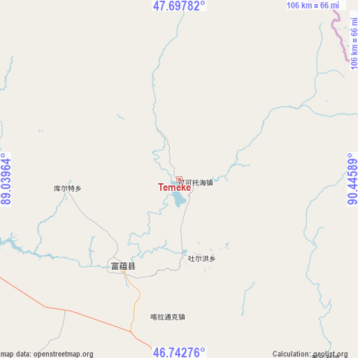
Temeke GPS coordinates[2]
47° 13' 20.784" North, 89° 44' 33.936" East
| Map corner | latitude | longitude |
|---|---|---|
| Upper-left | 47.69782°, | 89.03964° |
| Center: | 47.22244°, | 89.74276° |
| Lower-right: | 46.74276°, | 90.44589° |
| Map W x H: | 106.2×106.2 km | = 66×66mi |
| max Lat: | 53.31946° ⇑2.6% North |
| Temeke: | 47.22244° |
| min Lat: | ⇓97.4% South 18.22056° |
| min Long | Temeke | max Long |
| 75.07348° | 89.74276° | 134.28917° |
| W 2.7%⇐ | ⇒97.3% E |
Elevation
Elevation of Temeke is 1177 m = 3862 ft, and this is 692.2 m = 2271 ft above average elevation for this country.
| Max E: |
5622 m = 18445 ft | 12.1% |
| Temeke | 1177 m 3862 ft | |
| Avg. | 484.8 m = 1591 ft | |
Min E: |
-3 m = -10 ft | 87.9% |
See also: China elevation on elevation.city.
Geographical zone
Temeke is located in North temperate zone (between Tropic of Cancer and the Arctic Circle). Distance of this North polar circle is 2150.5 km =1336.3 mi to North.| Distance of | km | miles | from Temeke |
|---|---|---|---|
| North Pole | 4756.4 | 2955.5 | to North |
| Arctic Circle | 2150.5 | 1336.3 | to North |
| Tropic Cancer | 2644.7 | 1643.3 | to South |
| Equator | 5250.6 | 3262.6 | to South |


Nearby cities:
15 places around Temeke: (largest is in red/bold)
• Agax Obo
116.2 km =72.2 mi,  153°
153°
• Araltobe
85.9 km =53.4 mi,  155°
155°
• Arele
68.2 km =42.4 mi,  140°
140°
• Ertai
133.3 km =82.8 mi,  166°
166°
• Handegate
119.1 km =74 mi,  300°
300°
• Hongdun
127.4 km =79.2 mi, 295°
• Kalabulegen
120.7 km =75 mi,  221°
221°
• Kalatongke
40.9 km =25.4 mi,  184°
184°
• Koktokay
5.7 km =3.5 mi,  96°
96°
• Kürti
33.1 km =20.6 mi,  265°
265°
• Qagan Gol
112.4 km =69.8 mi, 137°
• Qahurt
99.5 km =61.8 mi,  186°
186°
• Qinghe
78.4 km =48.7 mi, 141°
• Turgun
28.1 km =17.5 mi, 164°
• Xirikxiy
130.9 km =81.3 mi,  276°
276°
Sources, notices
• [Note1] Compared only with cities in China existing in our database
• [Src1] Map data: © OpenStreetMap contributors (CC-BY-SA)
• [Src2] Other city data from geonames.org with taken over terms of usage.
• [Src3] Geographical zone / Annual Mean Temperature by Robert A. Rohde @ Wikipedia
