Kürti geodata
Kürti (Xinjiang) is a seat of a fourth-order administrative division; located in China in Asia/Urumqi (GMT+6) time zone. In our database, there are 1268 cities with bigger population. Compared to other cities in China, 97.3% of cities are located further ↓South; 97.5% of cities are located further →East and 85.4% of cities have lower elevation than Kürti. Note1


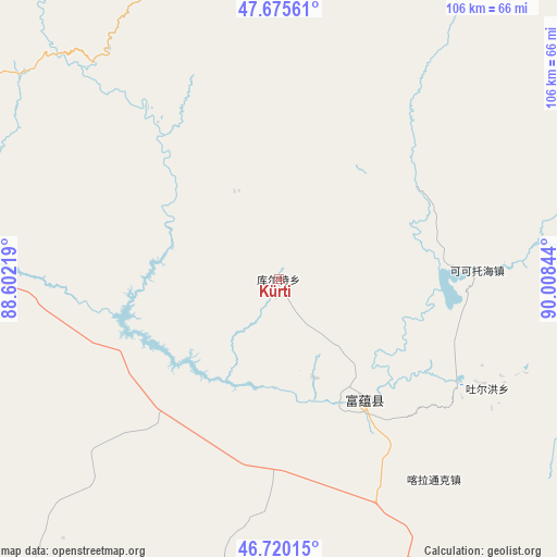
Kürti GPS coordinates[2]
47° 12' 0.108" North, 89° 18' 19.116" East
| Map corner | latitude | longitude |
|---|---|---|
| Upper-left | 47.67561°, | 88.60219° |
| Center: | 47.20003°, | 89.30531° |
| Lower-right: | 46.72015°, | 90.00844° |
| Map W x H: | 106.2×106.2 km | = 66×66mi |
| max Lat: | 53.31946° ⇑2.7% North |
| Kürti: | 47.20003° |
| min Lat: | ⇓97.3% South 18.22056° |
| min Long | Kürti | max Long |
| 75.07348° | 89.30531° | 134.28917° |
| W 2.5%⇐ | ⇒97.5% E |
Elevation
Elevation of Kürti is 1003 m = 3291 ft, and this is 518.2 m = 1700 ft above average elevation for this country.
| Max E: |
5622 m = 18445 ft | 14.6% |
| Kürti | 1003 m 3291 ft | |
| Avg. | 484.8 m = 1591 ft | |
Min E: |
-3 m = -10 ft | 85.4% |
See also: China elevation on elevation.city.
Geographical zone
Kürti is located in North temperate zone (between Tropic of Cancer and the Arctic Circle). Distance of this North polar circle is 2153 km =1337.8 mi to North.| Distance of | km | miles | from Kürti |
|---|---|---|---|
| North Pole | 4758.9 | 2957 | to North |
| Arctic Circle | 2153 | 1337.8 | to North |
| Tropic Cancer | 2642.2 | 1641.8 | to South |
| Equator | 5248.2 | 3261.1 | to South |


Nearby cities:
15 places around Kürti: (largest is in red/bold)
• Araltobe
102.5 km =63.7 mi,  137°
137°
• Arele
91.4 km =56.8 mi,  123°
123°
• Awiytan
110.9 km =68.9 mi,  301°
301°
• Beitun
113.3 km =70.4 mi,  278°
278°
• Dure
111.4 km =69.2 mi,  214°
214°
• Handegate
94 km =58.4 mi,  312°
312°
• Hongdun
100.4 km =62.4 mi, 305°
• Kalabulegen
99.4 km =61.8 mi, 208°
• Kalatongke
48.5 km =30.1 mi, 142°
• Koktokay
38.7 km =24 mi,  87°
87°
• Qahurt
98.8 km =61.4 mi,  167°
167°
• Qinghe
100.7 km =62.6 mi,  126°
126°
• Temeke
33.1 km =20.6 mi, 85°
• Turgun
47.6 km =29.6 mi, 121°
• Xirikxiy
98.7 km =61.3 mi, 280°
Sources, notices
• [Note1] Compared only with cities in China existing in our database
• [Src1] Map data: © OpenStreetMap contributors (CC-BY-SA)
• [Src2] Other city data from geonames.org with taken over terms of usage.
• [Src3] Geographical zone / Annual Mean Temperature by Robert A. Rohde @ Wikipedia
