Dongqinggou geodata
Dongqinggou (Qinghai) is a seat of a fourth-order administrative division; located in China in Asia/Shanghai (GMT+8) time zone. In our database, there are 1268 cities with bigger population. Compared to other cities in China, 72.9% of cities are located further ↓South; 94.6% of cities are located further →East and 98.2% of cities have lower elevation than Dongqinggou. Note1


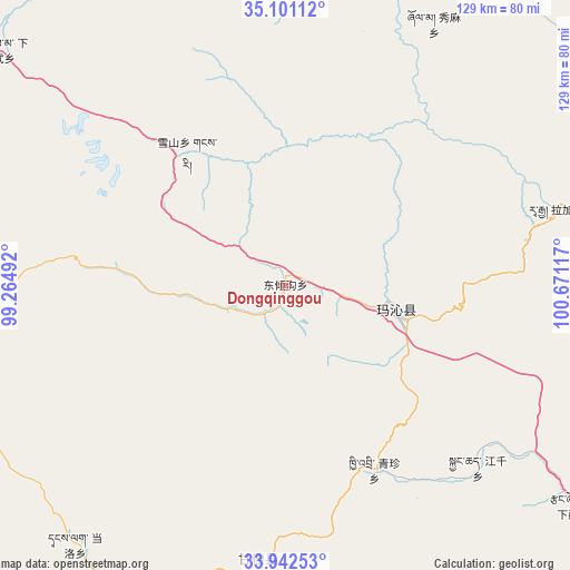
Dongqinggou GPS coordinates[2]
34° 31' 25.824" North, 99° 58' 4.944" East
| Map corner | latitude | longitude |
|---|---|---|
| Upper-left | 35.10112°, | 99.26492° |
| Center: | 34.52384°, | 99.96804° |
| Lower-right: | 33.94253°, | 100.67117° |
| Map W x H: | 128.8×128.8 km | = 80×80mi |
| max Lat: | 53.31946° ⇑27.1% North |
| Dongqinggou: | 34.52384° |
| min Lat: | ⇓72.9% South 18.22056° |
| min Long | Dongqinggou | max Long |
| 75.07348° | 99.96804° | 134.28917° |
| W 5.4%⇐ | ⇒94.6% E |
Elevation
Elevation of Dongqinggou is 3811 m = 12503 ft, and this is 3326.2 m = 10913 ft above average elevation for this country.
| Max E: |
5622 m = 18445 ft | 1.8% |
| Dongqinggou | 3811 m 12503 ft | |
| Avg. | 484.8 m = 1591 ft | |
Min E: |
-3 m = -10 ft | 98.2% |
See also: China elevation on elevation.city.
Geographical zone
Dongqinggou is located in North temperate zone (between Tropic of Cancer and the Arctic Circle). Distance of this Northern Tropic circle is 1232.8 km =766 mi to South.| Distance of | km | miles | from Dongqinggou |
|---|---|---|---|
| North Pole | 6168.4 | 3832.9 | to North |
| Arctic Circle | 3562.5 | 2213.6 | to North |
| Tropic Cancer | 1232.8 | 766 | to South |
| Equator | 3838.7 | 2385.3 | to South |


Nearby cities:
15 places around Dongqinggou: (largest is in red/bold)
• Changmahe
72.2 km =44.9 mi,  266°
266°
• Dawu
22.9 km =14.2 mi,  98°
98°
• Dawu
24.8 km =15.4 mi, 104°
• Gyangqai
56.1 km =34.9 mi,  135°
135°
• Kequ
62 km =38.5 mi,  185°
185°
• Kyinzhi
46.5 km =28.9 mi,  154°
154°
• Shanggongma
81.6 km =50.7 mi,  199°
199°
• Tanglag
75.7 km =47 mi,  219°
219°
• Wenquan
81.9 km =50.9 mi,  340°
340°
• Xia Dawo
83.8 km =52.1 mi,  309°
309°
• Xiagongma
83 km =51.6 mi,  167°
167°
• Xiuma
67.8 km =42.1 mi,  29°
29°
• Xueshan
37.4 km =23.2 mi,  323°
323°
• Youyun
76.6 km =47.6 mi,  248°
248°
• Zhongtie
81.6 km =50.7 mi,  10°
10°
Sources, notices
• [Note1] Compared only with cities in China existing in our database
• [Src1] Map data: © OpenStreetMap contributors (CC-BY-SA)
• [Src2] Other city data from geonames.org with taken over terms of usage.
• [Src3] Geographical zone / Annual Mean Temperature by Robert A. Rohde @ Wikipedia
