Youyun geodata
Youyun (Qinghai) is a seat of a fourth-order administrative division; located in China in Asia/Shanghai (GMT+8) time zone. In our database, there are 1268 cities with bigger population. Compared to other cities in China, 71.4% of cities are located further ↓South; 95% of cities are located further →East and 99% of cities have lower elevation than Youyun. Note1


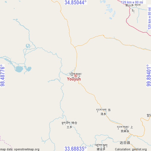
Youyun GPS coordinates[2]
34° 16' 17.04" North, 99° 11' 27.168" East
| Map corner | latitude | longitude |
|---|---|---|
| Upper-left | 34.85044°, | 98.48776° |
| Center: | 34.2714°, | 99.19088° |
| Lower-right: | 33.68835°, | 99.89401° |
| Map W x H: | 129.2×129.2 km | = 80.3×80.3mi |
| max Lat: | 53.31946° ⇑28.6% North |
| Youyun: | 34.2714° |
| min Lat: | ⇓71.4% South 18.22056° |
| min Long | Youyun | max Long |
| 75.07348° | 99.19088° | 134.28917° |
| W 5%⇐ | ⇒95% E |
Elevation
Elevation of Youyun is 4211 m = 13816 ft, and this is 3726.2 m = 12225 ft above average elevation for this country.
| Max E: |
5622 m = 18445 ft | 1% |
| Youyun | 4211 m 13816 ft | |
| Avg. | 484.8 m = 1591 ft | |
Min E: |
-3 m = -10 ft | 99% |
See also: China elevation on elevation.city.
Geographical zone
Youyun is located in North temperate zone (between Tropic of Cancer and the Arctic Circle). Distance of this Northern Tropic circle is 1204.7 km =748.6 mi to South.| Distance of | km | miles | from Youyun |
|---|---|---|---|
| North Pole | 6196.4 | 3850.3 | to North |
| Arctic Circle | 3590.6 | 2231.1 | to North |
| Tropic Cancer | 1204.7 | 748.6 | to South |
| Equator | 3810.6 | 2367.8 | to South |


Nearby cities:
15 places around Youyun: (largest is in red/bold)
• Changmahe
23.9 km =14.9 mi,  357°
357°
• Dawu
97.2 km =60.4 mi,  75°
75°
• Dongqinggou
76.6 km =47.6 mi,  68°
68°
• Huanghe
86.6 km =53.8 mi,  292°
292°
• Jianshe
68.2 km =42.4 mi,  163°
163°
• Jimai
71.5 km =44.4 mi,  143°
143°
• Kequ
73.5 km =45.7 mi,  117°
117°
• Kyinzhi
92.7 km =57.6 mi,  98°
98°
• Sangruma
69.1 km =42.9 mi,  179°
179°
• Shanggongma
65.5 km =40.7 mi, 138°
• Tanglag
38.5 km =23.9 mi, 142°
• Tehetu
42.2 km =26.2 mi,  187°
187°
• Wosai
92 km =57.2 mi, 142°
• Xia Dawo
81.7 km =50.8 mi,  4°
4°
• Xueshan
76.1 km =47.3 mi,  40°
40°
Sources, notices
• [Note1] Compared only with cities in China existing in our database
• [Src1] Map data: © OpenStreetMap contributors (CC-BY-SA)
• [Src2] Other city data from geonames.org with taken over terms of usage.
• [Src3] Geographical zone / Annual Mean Temperature by Robert A. Rohde @ Wikipedia
