Pingyuan geodata
Pingyuan (Yunnan) is a seat of a third-order administrative division; located in China in Asia/Shanghai (GMT+8) time zone. In our database, there are 1268 cities with bigger population. Compared to other cities in China, 87.5% of cities are located further ↑North; 95.5% of cities are located further →East and 82.9% of cities have lower elevation than Pingyuan. Note1


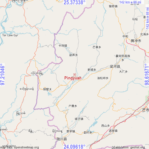
Pingyuan GPS coordinates[2]
24° 44' 11.112" North, 97° 54' 48.888" East
| Map corner | latitude | longitude |
|---|---|---|
| Upper-left | 25.37338°, | 97.21046° |
| Center: | 24.73642°, | 97.91358° |
| Lower-right: | 24.09618°, | 98.61671° |
| Map W x H: | 142×142 km | = 88.2×88.2mi |
| max Lat: | 53.31946° ⇑87.5% North |
| Pingyuan: | 24.73642° |
| min Lat: | ⇓12.5% South 18.22056° |
| min Long | Pingyuan | max Long |
| 75.07348° | 97.91358° | 134.28917° |
| W 4.5%⇐ | ⇒95.5% E |
Elevation
Elevation of Pingyuan is 839 m = 2753 ft, and this is 354.2 m = 1162 ft above average elevation for this country.
| Max E: |
5622 m = 18445 ft | 17.1% |
| Pingyuan | 839 m 2753 ft | |
| Avg. | 484.8 m = 1591 ft | |
Min E: |
-3 m = -10 ft | 82.9% |
See also: China elevation on elevation.city.
Geographical zone
Pingyuan is located in North temperate zone (between Tropic of Cancer and the Arctic Circle). Distance of this Northern Tropic circle is 144.5 km =89.8 mi to South.| Distance of | km | miles | from Pingyuan |
|---|---|---|---|
| North Pole | 7256.6 | 4509 | to North |
| Arctic Circle | 4650.7 | 2889.8 | to North |
| Tropic Cancer | 144.5 | 89.8 | to South |
| Equator | 2750.4 | 1709 | to South |


Nearby cities:
15 places around Pingyuan: (largest is in red/bold)
• Aihua
223.9 km =139.1 mi,  99°
99°
• Dedang
156.6 km =97.3 mi,  120°
120°
• Dianyang
125.9 km =78.2 mi,  91°
91°
• Fengshan
201.4 km =125.1 mi, 94°
• Gengma
200.7 km =124.7 mi,  132°
132°
• Laojie
183.4 km =114 mi,  64°
64°
• Longshan
81.3 km =50.5 mi, 100°
• Luzhang
165.1 km =102.6 mi,  33°
33°
• Mengdong
218.7 km =135.9 mi,  143°
143°
• Nansan
138.1 km =85.8 mi, 139°
• Shimen
199.5 km =124 mi,  49°
49°
• Tengyue
66.9 km =41.6 mi, 64°
• Youdian
169.8 km =105.5 mi, 86°
• Zhangfeng
58.7 km =36.5 mi,  192°
192°
• Zhedao
37.8 km =23.5 mi,  75°
75°
Sources, notices
• [Note1] Compared only with cities in China existing in our database
• [Src1] Map data: © OpenStreetMap contributors (CC-BY-SA)
• [Src2] Other city data from geonames.org with taken over terms of usage.
• [Src3] Geographical zone / Annual Mean Temperature by Robert A. Rohde @ Wikipedia
