Toksun geodata
Toksun (Xinjiang) is a seat of a third-order administrative division; located in China in Asia/Urumqi (GMT+6) time zone. In our database, there are 1268 cities with bigger population. Compared to other cities in China, 91.7% of cities are located further ↓South; 97.8% of cities are located further →East and 97.2% of cities have higher elevation than Toksun. Note1


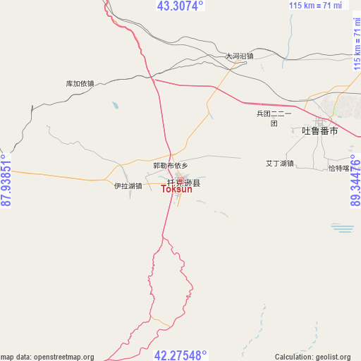
Toksun GPS coordinates[2]
42° 47' 36.924" North, 88° 38' 29.868" East
| Map corner | latitude | longitude |
|---|---|---|
| Upper-left | 43.3074°, | 87.93851° |
| Center: | 42.79359°, | 88.64163° |
| Lower-right: | 42.27548°, | 89.34476° |
| Map W x H: | 114.7×114.7 km | = 71.3×71.3mi |
| max Lat: | 53.31946° ⇑8.3% North |
| Toksun: | 42.79359° |
| min Lat: | ⇓91.7% South 18.22056° |
| min Long | Toksun | max Long |
| 75.07348° | 88.64163° | 134.28917° |
| W 2.2%⇐ | ⇒97.8% E |
Elevation
Elevation of Toksun is 5 m = 16 ft, and this is 479.8 m = 1574 ft below average elevation for this country.
| Max E: |
5622 m = 18445 ft | 97.2% |
| Avg. | 484.8 m = 1591 ft | |
| Toksun | 5 m = 16 ft | |
Min E: |
-3 m = -10 ft | 2.8% |
See also: China elevation on elevation.city.
Geographical zone
Toksun is located in North temperate zone (between Tropic of Cancer and the Arctic Circle). Distance of this Northern Tropic circle is 2152.3 km =1337.4 mi to South.| Distance of | km | miles | from Toksun |
|---|---|---|---|
| North Pole | 5248.9 | 3261.5 | to North |
| Arctic Circle | 2643 | 1642.3 | to North |
| Tropic Cancer | 2152.3 | 1337.4 | to South |
| Equator | 4758.2 | 2956.6 | to South |


Nearby cities:
15 places around Toksun: (largest is in red/bold)
• Beijinglu
144.3 km =89.7 mi,  323°
323°
• Dabancheng
68 km =42.3 mi,  337°
337°
• Ewirgol
82.1 km =51 mi,  283°
283°
• Jimsar
136.7 km =84.9 mi,  14°
14°
• Jimusa’er
140 km =87 mi,  17°
17°
• Lucaogou
138 km =85.7 mi,  329°
329°
• Qingyanghu
145.7 km =90.5 mi, 10°
• Santai
145.5 km =90.4 mi, 7°
• Shanshan
127.7 km =79.3 mi,  86°
86°
• Shuimogou
140.8 km =87.5 mi, 324°
• Tiechanggou
142.9 km =88.8 mi, 330°
• Turpan
47 km =29.2 mi,  68°
68°
• Xingfulu
136.8 km =85 mi, 323°
• Yangzi Jianglu
138.3 km =85.9 mi, 321°
• Ürümqi
140.2 km =87.1 mi, 323°
Sources, notices
• [Note1] Compared only with cities in China existing in our database
• [Src1] Map data: © OpenStreetMap contributors (CC-BY-SA)
• [Src2] Other city data from geonames.org with taken over terms of usage.
• [Src3] Geographical zone / Annual Mean Temperature by Robert A. Rohde @ Wikipedia
