Ewirgol geodata
Ewirgol (Xinjiang) is a seat of a fourth-order administrative division; located in China in Asia/Urumqi (GMT+6) time zone. In our database, there are 1268 cities with bigger population. Compared to other cities in China, 92% of cities are located further ↓South; 98% of cities are located further →East and 91.1% of cities have lower elevation than Ewirgol. Note1


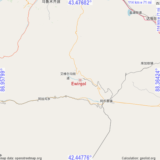
Ewirgol GPS coordinates[2]
42° 57' 51.984" North, 87° 39' 39.996" East
| Map corner | latitude | longitude |
|---|---|---|
| Upper-left | 43.47682°, | 86.95799° |
| Center: | 42.96444°, | 87.66111° |
| Lower-right: | 42.44776°, | 88.36424° |
| Map W x H: | 114.4×114.4 km | = 71.1×71.1mi |
| max Lat: | 53.31946° ⇑8% North |
| Ewirgol: | 42.96444° |
| min Lat: | ⇓92% South 18.22056° |
| min Long | Ewirgol | max Long |
| 75.07348° | 87.66111° | 134.28917° |
| W 2%⇐ | ⇒98% E |
Elevation
Elevation of Ewirgol is 1470 m = 4823 ft, and this is 985.2 m = 3232 ft above average elevation for this country.
| Max E: |
5622 m = 18445 ft | 8.9% |
| Ewirgol | 1470 m 4823 ft | |
| Avg. | 484.8 m = 1591 ft | |
Min E: |
-3 m = -10 ft | 91.1% |
See also: China elevation on elevation.city.
Geographical zone
Ewirgol is located in North temperate zone (between Tropic of Cancer and the Arctic Circle). Distance of this Northern Tropic circle is 2171.3 km =1349.2 mi to South.| Distance of | km | miles | from Ewirgol |
|---|---|---|---|
| North Pole | 5229.9 | 3249.7 | to North |
| Arctic Circle | 2624 | 1630.5 | to North |
| Tropic Cancer | 2171.3 | 1349.2 | to South |
| Equator | 4777.2 | 2968.4 | to South |


Nearby cities:
15 places around Ewirgol: (largest is in red/bold)
• Anningqu
113.8 km =70.7 mi,  354°
354°
• Beijinglu
97 km =60.3 mi,  355°
355°
• Dabancheng
69.1 km =42.9 mi,  50°
50°
• Diwopu
103.2 km =64.1 mi, 352°
• Ergong
98.8 km =61.4 mi, 355°
• Gumudi
110.1 km =68.4 mi,  0°
0°
• Hoxut
102.4 km =63.6 mi,  219°
219°
• Huoche Xizhan
102.7 km =63.8 mi, 349°
• Lucaogou
100.8 km =62.6 mi,  5°
5°
• Shuimogou
96.1 km =59.7 mi, 358°
• Tiechanggou
106.3 km =66.1 mi, 5°
• Toksun
82.1 km =51 mi,  103°
103°
• Xingfulu
91 km =56.5 mi, 358°
• Yangzi Jianglu
90.1 km =56 mi, 356°
• Ürümqi
93.1 km =57.8 mi, 356°
Sources, notices
• [Note1] Compared only with cities in China existing in our database
• [Src1] Map data: © OpenStreetMap contributors (CC-BY-SA)
• [Src2] Other city data from geonames.org with taken over terms of usage.
• [Src3] Geographical zone / Annual Mean Temperature by Robert A. Rohde @ Wikipedia
