Xujiaba geodata
Xujiaba (Guizhou) is a populated place; located in China in Asia/Shanghai (GMT+8) time zone. With population of 3,989 people, there are 896 cities with bigger population in this country. Compared to other cities in China, 74.7% of cities are located further ↑North; 80.1% of cities are located further →East and 77.4% of cities have lower elevation than Xujiaba. Note1


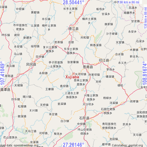
Xujiaba GPS coordinates[2]
27° 53' 4.992" North, 108° 6' 48.996" East
| Map corner | latitude | longitude |
|---|---|---|
| Upper-left | 28.50441°, | 107.41049° |
| Center: | 27.88472°, | 108.11361° |
| Lower-right: | 27.26146°, | 108.81674° |
| Map W x H: | 138.2×138.2 km | = 85.9×85.9mi |
| max Lat: | 53.31946° ⇑74.7% North |
| Xujiaba: | 27.88472° |
| min Lat: | ⇓25.3% South 18.22056° |
| min Long | Xujiaba | max Long |
| 75.07348° | 108.11361° | 134.28917° |
| W 19.9%⇐ | ⇒80.1% E |
Elevation
Elevation of Xujiaba is 589 m = 1932 ft, and this is 104.2 m = 342 ft above average elevation for this country.
| Max E: |
5622 m = 18445 ft | 22.6% |
| Xujiaba | 589 m 1932 ft | |
| Avg. | 484.8 m = 1591 ft | |
Min E: |
-3 m = -10 ft | 77.4% |
See also: China elevation on elevation.city.
Geographical zone
Xujiaba is located in North temperate zone (between Tropic of Cancer and the Arctic Circle). Distance of this Northern Tropic circle is 494.6 km =307.3 mi to South.| Distance of | km | miles | from Xujiaba |
|---|---|---|---|
| North Pole | 6906.6 | 4291.6 | to North |
| Arctic Circle | 4300.7 | 2672.3 | to North |
| Tropic Cancer | 494.6 | 307.3 | to South |
| Equator | 3100.5 | 1926.6 | to South |


Nearby cities:
15 places around Xujiaba: (largest is in red/bold)
• Changbao
37.6 km =23.4 mi,  25°
25°
• Chaodi
26.8 km =16.7 mi, 25°
• Dabachang
27.6 km =17.1 mi,  124°
124°
• Donghua
21.8 km =13.5 mi,  353°
353°
• Eling
31 km =19.3 mi,  65°
65°
• Fengxiangxi
34 km =21.1 mi,  37°
37°
• Fuxing
32.1 km =19.9 mi,  316°
316°
• Gonghe
36.4 km =22.6 mi,  15°
15°
• Hexing
24.6 km =15.3 mi, 348°
• Huaping
35.9 km =22.3 mi,  298°
298°
• Jiancha
32.5 km =20.2 mi,  334°
334°
• Kuanping
18.2 km =11.3 mi, 328°
• Langxi
38.5 km =23.9 mi, 68°
• Yantang
37.7 km =23.4 mi,  358°
358°
• Zhongba
26.8 km =16.7 mi,  54°
54°
Sources, notices
• [Note1] Compared only with cities in China existing in our database
• [Src1] Map data: © OpenStreetMap contributors (CC-BY-SA)
• [Src2] Other city data from geonames.org with taken over terms of usage.
• [Src3] Geographical zone / Annual Mean Temperature by Robert A. Rohde @ Wikipedia
